Oaklands, New South Wales
Town in New South Wales, Australia
35°32′0″S 146°10′0″E / 35.53333°S 146.16667°E / -35.53333; 146.16667- 615 km (382 mi) SW of Sydney
- 335 km (208 mi) NW of Melbourne
- 144 km (89 mi) SW of Wagga Wagga
- 61 km (38 mi) NW of Corowa
Oaklands is a town in the Riverina district of southern New South Wales, Australia. The town is located 615 kilometres south west of the state capital, Sydney and 105 kilometres north west of Albury. Oaklands is in the Federation Council local government area and at the 2021 census, had a population of 304.[1]
Oaklands has a pub, bowls club, swimming pool, Kindergarten to Year 12 school, and day-care.
History
The earliest settlement in the district of Oaklands was by the Tyson brothers, James and William, in 1846. [2] Oaklands Post Office opened on 16 June 1890.[3]
The major industry in the Oaklands region is agriculture, including the production of wheat and rice and is a major grain handling area. It is the home of the Oaklands Diuris, a threatened native orchid that is currently only found in the Oaklands region.[4]
Rail
A standard gauge branch line from the New South Wales Government Railways Main South line at The Rock was extended from Lockhart to Oaklands in 1912.[5]
A broad gauge branch line from the Victorian Railways North East line at Benalla was extended from Yarrawonga to Oaklands in 1938, creating a break-of-gauge until the New South Wales line was closed south of Boree Creek. There are several stations between Yarrawonga and Oaklands.[6]
With the conversion of the North East railway to Albury to standard gauge in 2008, the Oaklands branch railway was for a time a gauge orphan. After much lobbying, the 113 kilometres (70 mi) branch was converted to 1,435 mm (4 ft 8+1⁄2 in).
Oaklands is located 313 km from Melbourne and 675 km from Sydney.
| Preceding station | Former Services | Following station | ||
|---|---|---|---|---|
| Terminus | Oaklands Line | Coorabin towards The Rock | ||
Gallery
-
 Former post office
 -
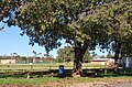 Australian rules football ground
 -
 Former butcher shop
 -
 Former CBC bank


References
- ^ a b Australian Bureau of Statistics (28 June 2022). "Oaklands". 2021 Census QuickStats. Retrieved 28 September 2023.

- ^ Terry, Mona (1985). The Light Shines On. A History of Oaklands. Lions Club of Oaklands. p. 275. ISBN 0958929904.
- ^ Phoenix Auctions History. "Post Office List". Retrieved 13 February 2021.
- ^ NSW Department of Environment and Conservation - Oaklands Diuris Retrieved 1 November 2006
- ^ "Oaklands Branch". www.nswrail.net. Retrieved 11 December 2006.
- ^ "Oaklands Branch". NSWrail.net. Retrieved 27 September 2023.
External links
 Media related to Oaklands, New South Wales at Wikimedia Commons
- v
- t
- e
Towns in the Federation Council local government area
Main Article: Local government areas of New South Wales


