Belčji Vrh
Place in White Carniola, Slovenia
45°29′52.71″N 15°12′34.45″E / 45.4979750°N 15.2095694°E / 45.4979750; 15.2095694 Slovenia
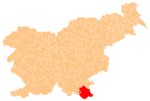
 (2020)
Belčji Vrh (pronounced [ˈbeːltʃji ˈʋəɾx]; German: Weltschberg[2]) is a village south of the town of Črnomelj in the White Carniola area of southeastern Slovenia. The area is part of the traditional region of Lower Carniola and is now included in the Southeast Slovenia Statistical Region.[3]
Name
Belčji Vrh was attested in historical documents as Polcz in 1458, Pälcz in 1464, and Wirlsperg in 1468, among other spellings.[4]
Church
The local church is dedicated to Saint Helena and belongs to the Parish of Dragatuš. It was first mentioned in written documents dating to 1526, but was refurbished in the Baroque style in the mid-18th century. The main altar dates to the second half of the 19th century.[5]
References
- ^ Statistical Office of the Republic of Slovenia
- ^ Leksikon občin kraljestev in dežel zastopanih v državnem zboru, vol. 6: Kranjsko. 1906. Vienna: C. Kr. Dvorna in Državna Tiskarna, p. 6.
- ^ Črnomelj municipal site
- ^ "Belčji Vrh". Slovenska historična topografija. ZRC SAZU Zgodovinski inštitut Milka Kosa. Retrieved February 7, 2021.
- ^ Slovenian Ministry of Culture register of national heritage reference number ešd 1797
External links
- Belčji Vrh on Geopedia
- v
- t
- e
Administrative seat: Črnomelj
- Črnomelj Castle
- Črnomelj Mithraeum
- Lahinja Regional Park
- Stonič Castle
- St. Peter's Parish Church
 | This article about the Municipality of Črnomelj in Slovenia is a stub. You can help Wikipedia by expanding it. |
- v
- t
- e


