Mavrlen
Place in White Carniola, Slovenia
45°34′20.04″N 15°8′12.54″E / 45.5722333°N 15.1368167°E / 45.5722333; 15.1368167 Slovenia
 (2020)
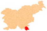
Mavrlen (pronounced [ˈmaːʋəɾlɛn]; in older sources also Maverl,[2] German: Maierle[2][3]) is a settlement in the hills west of Črnomelj in the White Carniola area of southeastern Slovenia. The area is part of the traditional region of Lower Carniola and is now included in the Southeast Slovenia Statistical Region.[4]
In the 16th century the village was settled by Gottschee Germans, who remained in the settlement until 1941.[5]
In September 2017, a 71-year-old woman was mauled to death by three pit bulls in Mavrlen.[6]
References
- ^ Statistical Office of the Republic of Slovenia
- ^ a b Leksikon občin kraljestev in dežel zastopanih v državnem zboru, vol. 6: Kranjsko. 1906. Vienna: C. Kr. Dvorna in Državna Tiskarna, p. 4.
- ^ Ferenc, Mitja. 2007. Nekdanji nemški jezikovni otok na kočevskem. Kočevje: Pokrajinski muzej, p. 4.
- ^ Črnomelj municipal site
- ^ Gottschee site
- ^ "Dog mauling happened at unlicensed breeder's". Slovenian Press Agency. 13 September 2017.
External links
- Mavrlen on Geopedia
- Pre–World War II map of Mavrlen with oeconyms and family names
- v
- t
- e
Administrative seat: Črnomelj
- Črnomelj Castle
- Črnomelj Mithraeum
- Lahinja Regional Park
- Stonič Castle
- St. Peter's Parish Church
 | This article about the Municipality of Črnomelj in Slovenia is a stub. You can help Wikipedia by expanding it. |
- v
- t
- e


