Nancowry
| Nancowry | |
|---|---|
  Nancowry | |
| Địa lý | |
| Vị trí | Vịnh Bengal |
| Tọa độ | 7°59′B 93°33′Đ / 7,98°B 93,55°Đ / 7.98; 93.55 |
| Quần đảo | Quần đảo Nicobar |
| Tổng số đảo | 1 |
| Đảo chính |
|
| Diện tích | 47 km2 (18,1 mi2)[1] |
| Dài | 11,2 km (69,6 mi) |
| Rộng | 7,5 km (46,6 mi) |
| Đường bờ biển | 47 km (29,2 mi) |
| Độ cao tương đối lớn nhất | 162 m (531 ft) |
| Hành chính | |
| Huyện | Nicobar |
| Island group | quần đảo Nicobar |
| Subdivisions of India | Nancowry Subdivision |
| Thành phố lớn nhất | Mayo (Malacca) Point (516 dân) |
| Nhân khẩu học | |
| Dân số | 1019 (tính đến 2011) |
| Mật độ | 21,7 /km2 (56,2 /sq mi) |
| Dân tộc | Hindu, Nicobarese |
| Thông tin khác | |
| Múi giờ |
|
| PIN | 744301 |
| Telephone code | 03192 |
| Trang web | www |
| Literacy | 84.4% |
| Avg. summer temperature | 32,0 °C (89,6 °F) |
| Avg. winter temperature | 28,0 °C (82,4 °F) |
| Sex ratio | ♂/♀ |
| Census Code | 35.638.0002 |
| Official Languages | Hindi, English, Tamil Car (regional) |

Nancowry (tiếng Hindi: नन्कोव्री Nankovri) là tên của một hòn đảo đồng thời là đơn vị hành chính dưới huyện nằm ở giữa quần đảo Nicobar, thuộc huyện Nicobar, Ấn Độ.
Hình ảnh
-
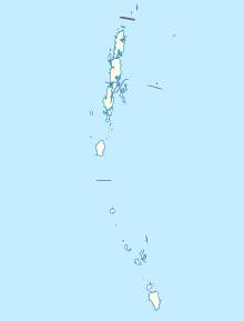
 Map
Map -
 Malacca village 1870


Chú thích
- ^ “Islandwise Area and Population – 2011 Census” (PDF). Government of Andaman. Bản gốc (PDF) lưu trữ ngày 28 tháng 8 năm 2017. Truy cập ngày 1 tháng 11 năm 2017.
Tham khảo
 Cổng thông tin India

- Space Shuttle Photo of Nancowry and surrounding islands (courtesy Earth Sciences and Image Analysis, NASA-Johnson Space Center). Lưu trữ 2011-05-14 tại Wayback Machine Nancowry is the island on the bottom right. Adjoining it, with Nancowry Harbour between, is Camorta (Kamorta) Is. to the north (up) and Katchall Is. to the west (left).
- Government of the Andaman and Nicobar Union Territory (tsunami damage page) Lưu trữ 2018-12-26 tại Wayback Machine
- Andaman and Nicobar Police Lưu trữ 2012-04-15 tại Wayback Machine
- Nicobar Islands, V19 Encyclopædia Britannica 661 (1911) Lưu trữ 2013-02-05 tại Wayback Machine
- “Nicobar Islands rain forests”. Khu vực sinh thái lục địa. Quỹ Quốc tế Bảo vệ Thiên nhiên.
- M.V.R. Murti, et al., Evaluation of Coral Systems through Remote Sensing – A case study in Nicobar Islands, India, presented at Poster Session 2, ACRS 1991. Includes various close-up line maps of the Nancowry group.
- Before-and-after satellite photos of Katchall island Lưu trữ 2005-02-08 tại Wayback Machine
 Hướng dẫn du lịch Andaman and Nicobar Islands từ Wikivoyage


