Thomaston, Georgia
| Thomaston | |
| city | |
 Domstolsbyggnaden i Upson County | |
| Land |  USA USA |
|---|---|
| Delstat | Georgia |
| County | Upson County |
| Koordinater | 32°53′30″N 84°19′36″V / 32.89167°N 84.32667°V / 32.89167; -84.32667 |
| Yta | 25,2 km² (2010)[1] |
| - land | 24,7 km² |
| - vatten | 0,5 km² |
| Folkmängd | 9 170 (2010)[2] |
| Befolkningstäthet | 371 invånare/km² |
| Grundad | 1825 |
| Tidszon | EST (UTC-5) |
| - sommartid | EDT (UTC-4) |
| ZIP-kod | 30286[3] |
| FIPS | 1376168 |
| Geonames | 4226364 |
  Ortens läge i Georgia | |
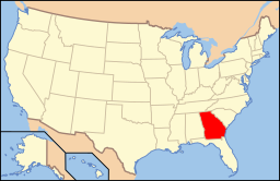 Georgias läge i USA | |
| Webbplats: http://www.thomastonga.com/ | |
Thomaston är en stad i Upson County i den amerikanska delstaten Georgia med en yta av 23,8 km² och en folkmängd, som uppgår till 9 638 invånare (2006). Thomaston är administrativ huvudort i Upson County.
Källor
- ^ ”2010 Census Gazetteer Files”. US Census Bureau. Arkiverad från originalet den 14 juli 2012. https://www.webcitation.org/699nOulzi?url=http://www.census.gov/geo/www/gazetteer/files/Gaz_places_national.txt. Läst 14 juli 2012.
- ^ ”Thomaston (city), Georgia” (på engelska). State & County Quickfacts. U.S. Census Bureau,. Arkiverad från originalet den 21 juli 2012. https://www.webcitation.org/69KQAQzHo?url=http://quickfacts.census.gov/qfd/states/13/1376168.html. Läst 21 juli 2012.
- ^ ”2010 ZIP Code Tabulation Area (ZCTA) Relationship Files”. U.S. Census Bureau. 20 juni 2010. Arkiverad från originalet den 25 augusti 2012. https://www.webcitation.org/6ABdwXxbq?url=http://www.census.gov/geo/www/2010census/zcta_rel/zcta_place_rel_10.txt. Läst 25 augusti 2012.


