Villa de Vallecas
District of Madrid in Spain
Villa de Vallecas | |
|---|---|
District of Madrid | |
 | |
| Country |  Spain Spain |
| Aut. community |  Madrid Madrid |
| Municipality |  Madrid Madrid |
| Population | 65,162 |
| Madrid district number | 18 |
 | |
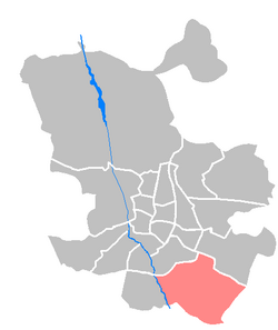
Villa de Vallecas ([ˈbiʝa ðe βaˈʝekas], "Village of Vallecas") is one of the 21 districts of the city of Madrid, Spain. It forms, with the district of Puente de Vallecas, the geographical area of Vallecas.
Geography
Subdivision
The district is administratively divided into 3 wards (Barrios):
- Casco Histórico de Vallecas
- Santa Eugenia
- Ensanche de Vallecas
External links
![]() Media related to Villa de Vallecas at Wikimedia Commons
Media related to Villa de Vallecas at Wikimedia Commons
- v
- t
- e
Districts and wards of Madrid
- Atocha
- Imperial
- La Chopera
- Las Acacias
- Las Delicias
- Legazpi
- Palos de Moguer


- Aeropuerto
- Alameda de Osuna
- Casco Histórico de Barajas
- Corralejos
- Timón
- Abrantes
- Buenavista
- Comillas
- Opañel
- Puerta Bonita
- San Isidro
- Vista Alegre
- Cortes
- Embajadores
- Justicia
- Universidad
- Palacio
- Sol
- Castilla
- Ciudad Jardín
- El Viso
- Hispanoamérica
- Nueva España
- Prosperidad
- Almagro
- Arapiles
- Gaztambide
- Ríos Rosas
- Trafalgar
- Vallehermoso
- Atalaya
- Colina
- Concepción
- Pinar de Chamartín
- Pueblo Nuevo
- Quintana
- San Juan Bautista
- San Pascual
- Ventas
- Barrio del Pilar
- El Goloso
- El Pardo
- Fuentelarreina
- La Paz
- Mirasierra
- Peñagrande
- Valverde
- Apóstol Santiago
- Canillas
- Palomas
- Pinar del Rey
- Piovera
- Valdefuentes
- Aluche
- Campamento
- Cuatro Vientos
- Las Águilas
- Lucero
- Los Cármenes
- Puerta del Ángel
- Aravaca
- Argüelles
- Casa de Campo
- Ciudad Universitaria
- El Plantío
- Valdemarín
- Valdezarza
- Fontarrón
- Horcajo
- Marroquina
- Media Legua
- Pavones
- Vinateros
- Entrevías
- Numancia
- Palomeras Bajas
- Palomeras Sureste
- Portazgo
- San Diego
- Adelfas
- Estrella
- Ibiza
- Jerónimos
- Niño Jesús
- Pacífico
- Castellana
- Fuente del Berro
- Goya
- Guindalera
- Lista
- Recoletos
- Amposta
- Arcos
- Canillejas
- Hellín
- Rejas
- Rosas
- Salvador
- Simancas
- Almenara
- Bellas Vistas
- Berruguete
- Castillejos
- Cuatro Caminos
- Valdeacederas
- Almendrales
- Moscardó
- Orcasitas
- Orcasur
- Pradolongo
- San Fermín
- Zofío
- Ambroz
- Casco Histórico de Vicálvaro
- Casco Histórico de Vallecas
- Santa Eugenia
- Butarque
- Los Ángeles
- Los Rosales
- San Cristóbal de los Ángeles
- Villaverde Alto
Authority control databases | |
|---|---|
| International |
|
| National |
|
40°22′47″N 3°37′17″W / 40.379597°N 3.621347°W / 40.379597; -3.621347
 | This article about a location in the Community of Madrid, Spain is a stub. You can help Wikipedia by expanding it. |
- v
- t
- e


