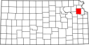
Union Township, Jefferson County, Kansas
Township in Kansas, United States
39°12′58″N 95°13′03″W / 39.21611°N 95.21750°W / 39.21611; -95.21750 (2000)
Union Township is a township in Jefferson County, Kansas, USA. As of the 2000 census, its population was 1,672.
Geography
Union Township covers an area of 42.83 square miles (110.92 square kilometers); of this, 0.13 square miles (0.33 square kilometers) or 0.3 percent is water. The stream of Scatter Creek runs through this township.
Cities and towns
- McLouth
Adjacent townships
- Jefferson Township (north)
- Alexandria Township, Leavenworth County (northeast)
- Tonganoxie Township, Leavenworth County (southeast)
- Sarcoxie Township (south)
- Oskaloosa Township (west)
Cemeteries
The township contains one cemetery, Fowler.
Major highways
- K-16
- K-92
Airports and landing strips
- Threshing Bee Airport
References
- U.S. Board on Geographic Names (GNIS)
- United States Census Bureau cartographic boundary files
External links
- US-Counties.com
- City-Data.com
- v
- t
- e
Municipalities and communities of Jefferson County, Kansas, United States
County seat: Oskaloosa
- McLouth
- Meriden
- Nortonville
- Oskaloosa
- Ozawkie
- Perry
- Valley Falls
- Winchester
communities
†This community is designated a Census-Designated Place (CDP) by the United States Census Bureau.
- Kansas portal
- United States portal
 | This article about a location in Jefferson County, Kansas is a stub. You can help Wikipedia by expanding it. |
- v
- t
- e


