Solano, New Mexico
Unincorporated community in New Mexico, United States
35°50′59″N 104°04′07″W / 35.84972°N 104.06861°W / 35.84972; -104.0686187746
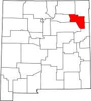
Solano is an unincorporated community in Harding County, New Mexico, United States, founded in 1907. It lies along NM 39 and the tracks of a spur of the Southern Pacific Railroad[1] about half-way between Roy and Mosquero. The post office was opened in 1907.[1][2]
History
Solano began in 1907 when F. M. Hughes built his house and a store.[3] It was named after a local mail carrier, Cipriano Solano.[2] Solano was the largest town in Harding County for a time, and even published a local newspaper, The Solano Herald, but when the coal mines in Dawson shut down in the 1950s, its importance waned.[3]
References
- ^ a b Pearce, T. M. (1965) "Solano" New Mexico Place Names; A Geographical Dictionary University of New Mexico Press, Albuquerque, New Mexico, page 158, OCLC 420847
- ^ a b Julyan, Robert (1998) "Solano" Place Names of New Mexico (2nd ed.) University of New Mexico Press, Albuquerque, New Mexico, page 338, ISBN 0-8263-1689-1
- ^ a b "Solano, New Mexico" Archived February 2, 2011, at the Wayback Machine New Mexico Tourism Department
- v
- t
- e
Municipalities and communities of Harding County, New Mexico, United States
County seat: Mosquero
communities
‡This populated place also has portions in an adjacent county or counties
- New Mexico portal
- United States portal
Authority control databases | |
|---|---|
| International |
|
| National |
|
 | This New Mexico state location article is a stub. You can help Wikipedia by expanding it. |
- v
- t
- e


