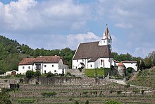
Senftenberg, Austria
Place in Lower Austria, Austria

Coat of arms
(2018-01-01)[2]
3541
Senftenberg is a town in the district of Krems-Land in the Austrian state of Lower Austria.
Geography
The municipality consists of six subdivisions:[3]
- Imbach (population: 580)
- Meislingeramt (population: 55)
- Priel (population: 123)
- Reichaueramt (population: 60)
- Senftenberg (population: 1046)
- Senftenbergeramt (population: 107)
Population
| Year | Pop. | ±% |
|---|---|---|
| 1869 | 1,694 | — |
| 1880 | 1,634 | −3.5% |
| 1890 | 1,654 | +1.2% |
| 1900 | 1,776 | +7.4% |
| 1910 | 2,015 | +13.5% |
| 1923 | 1,965 | −2.5% |
| 1934 | 1,907 | −3.0% |
| 1939 | 1,922 | +0.8% |
| 1951 | 2,017 | +4.9% |
| 1961 | 1,875 | −7.0% |
| 1971 | 1,937 | +3.3% |
| 1981 | 1,986 | +2.5% |
| 1991 | 2,067 | +4.1% |
| 2001 | 1,971 | −4.6% |
| 2011 | 1,937 | −1.7% |
Sights
- Burgruine Senftenberg
References
- ^ "Dauersiedlungsraum der Gemeinden Politischen Bezirke und Bundesländer - Gebietsstand 1.1.2018". Statistics Austria. Retrieved 10 March 2019.
- ^ "Einwohnerzahl 1.1.2018 nach Gemeinden mit Status, Gebietsstand 1.1.2018". Statistics Austria. Retrieved 9 March 2019.
- ^ Statistik Austria, Bevölkerung am 1.1.2015 nach Ortschaften
- ^ Statistik Austria, Ein Blick auf die Gemeinde Senftenberg
External links
Wikimedia Commons has media related to Senftenberg, Lower Austria.
- v
- t
- e
Municipalities in the district of Krems (Land)
- Aggsbach
- Albrechtsberg an der Großen Krems
- Bergern im Dunkelsteinerwald
- Droß
- Dürnstein
- Furth bei Göttweig
- Gedersdorf
- Gföhl
- Grafenegg
- Hadersdorf-Kammern
- Jaidhof
- Krumau am Kamp
- Langenlois
- Lengenfeld
- Lichtenau im Waldviertel
- Maria Laach am Jauerling
- Mautern an der Donau
- Mühldorf
- Paudorf
- Rastenfeld
- Rohrendorf bei Krems
- Rossatz-Arnsdorf
- Schönberg am Kamp
- Senftenberg
- Spitz
- St. Leonhard am Hornerwald
- Straß im Straßertale
- Stratzing
- Weinzierl am Walde
- Weißenkirchen in der Wachau

Authority control databases | |
|---|---|
| International |
|
| National |
|
 | This Lower Austria location article is a stub. You can help Wikipedia by expanding it. |
- v
- t
- e


