Rafi, Nigeria
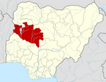
LGA in Niger State, Nigeria
10°11′04″N 6°15′12″E / 10.18444°N 6.25333°E / 10.18444; 6.25333 Nigeria
 (2006 census)
922

Rafi is a Local Government Area in Niger State, Nigeria. Its headquarters are in the town of Kagara on the A125 highway. The southern border of the area is the Kaduna River. Towns in the LGA include Tegina, and Pandogari
It has an area of 3,680 km2 and a population of 181,929 at the 2006 census.
The postal code of the area is 922.[1]
Languages in Rafi
References
- ^ "Post Offices- with map of LGA". NIPOST. Archived from the original on 2009-10-07. Retrieved 2009-10-20.
 | This Niger State, Nigeria location article is a stub. You can help Wikipedia by expanding it. |
- v
- t
- e


