Pushmataha, Alabama
Unincorporated community in Alabama, United States
Unincorporated community in Alabama, United States
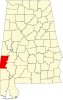
32°11′36″N 88°21′12″W / 32.19333°N 88.35333°W / 32.19333; -88.35333Pushmataha is an unincorporated community in Choctaw County, Alabama, United States.[1] It was named in honor of famed Choctaw chief Pushmataha.[2] Much of the community is part of the Pushmataha Historic District, listed on the Alabama Register of Landmarks and Heritage in October 2008.[3]
Pushmataha's population as an unincorporated community was listed as 124 at the 1880 U.S. Census, the only time a figure was returned.
Geography
Pushmataha is located at 32°11′36″N 88°21′12″W / 32.19347°N 88.35336°W / 32.19347; -88.35336 and has an elevation of 243 feet (74 m).[1]
Demographics
| Census | Pop. | Note | %± |
|---|---|---|---|
| 1880 | 124 | — | |
| U.S. Decennial Census[4] | |||
References
- ^ a b U.S. Geological Survey Geographic Names Information System: Pushmataha
- ^ Greg O'Brien (February 6, 2011). "Pushmataha". The Encyclopedia of Alabama. Auburn University. Retrieved July 23, 2011.
- ^ "The Alabama Register of Landmarks & Heritage" (PDF). preserveala.org. Alabama Historical Commission. May 31, 2011. Archived from the original (PDF) on June 6, 2011. Retrieved June 6, 2011.
- ^ "U.S. Decennial Census". Census.gov. Retrieved June 6, 2013.
- v
- t
- e
Municipalities and communities of Choctaw County, Alabama, United States
County seat: Butler
communities
‡This populated place also has portions in an adjacent county or counties
- Alabama portal
- United States portal
 | This Choctaw County, Alabama state location article is a stub. You can help Wikipedia by expanding it. |
- v
- t
- e


