Mula Dam
Dam in Rahuri
19°19′46″N 74°31′46″E / 19.3293065°N 74.5295548°E / 19.3293065; 74.5295548Gravity
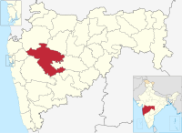
Mula Dam is an earthfill and gravity dam on Mula river near Rahuri in Ahmednagar district of the state of Maharashtra in India.
Specifications
The height of the dam above lowest foundation is 48.17 m (158.0 ft) while the length is 2,856 m (9,370 ft). The volume content is 7,594 km3 (1,822 cu mi) and gross storage capacity is 736,320.00 km3 (176,652.56 cu mi)Water capacity is 26 TMC.[1]
Purpose
- Irrigation: Has canals on either bank flowing downstream through the Ahmednagar district towards Aurangabad district irrigating the water deficient central eastern region of the Ahmednagar district. It is also the principal source of water for the Mahatma Phule Krishi Vidyapeeth.
- Drinking Water: It also provides drinking water supply to perennially water deficient Ahmednagar city. The water is transported via pipeline from the dam to the Ahmednagar city.
See also
- Dams in Maharashtra
- List of reservoirs and dams in India
References
- ^ "Specifications of large dams in India" (PDF). Archived from the original (PDF) on 2011-07-21. Retrieved 2010-10-22.
- v
- t
- e
Ahmednagar district topics
- Ahmadnagar Sultanate
- Daimabad
- Jorwe
- Kharda
- Godavari River
- Kalsubai peak
- Harishchandragad
- Adhala Dam
- Bhandardara
- Dhoki Dam
- Ghod Dam
- Hanga Dam
- Khairi Dam
- Lonimavla Dam
- Mandohol Dam
- Mula Dam
- Nilwande Dam
- Palashi Dam
- Rui Chatrapati Dam
- Sina Dam
- Tikhol Dam
- Visapur Dam
- Tamkada Dam
- Wanarshi Dam


