Morrison, Wisconsin
Town in Wisconsin, United States
44°16′57″N 87°56′55″W / 44.28250°N 87.94861°W / 44.28250; -87.94861 United States
 Wisconsin
 (2010)

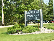
Morrison is a town in Brown County in the U.S. state of Wisconsin. The population was 1,599 at the 2010 census.[3]
Communities
- Lark is an unincorporated community located at the intersection of WIS 96 and Dickinson Road.
- Morrison is an unincorporated community located at the intersection of County Road W, Mill and Morrison Roads.
- Wayside is an unincorporated community located at the intersection of County Road W and Wayside Road.
Geography
Morrison is located in southern Brown County and is bounded by Manitowoc County to the south and the east. According to the United States Census Bureau, the town has a total area of 36.43 square miles (94.35 km2), of which 36.30 square miles (94.01 km2) is land and 0.14 square miles (0.35 km2), or 0.37%, is water.[3]
Demographics
As of the census[2] of 2000, there were 1,651 people, 564 households, and 457 families residing in the town. The population density was 47.1 people per square mile (18.2/km2). There were 579 housing units at an average density of 16.5 per square mile (6.4/km2). The racial makeup of the town was 98.36% White, 0.24% African American, 0.12% Native American, 0.12% Asian, 0.61% from other races, and 0.55% from two or more races. Hispanic or Latino of any race were 0.91% of the population.
There were 564 households, out of which 38.5% had children under the age of 18 living with them, 73.0% were married couples living together, 4.6% had a female householder with no husband present, and 18.8% were non-families. 14.4% of all households were made up of individuals, and 6.0% had someone living alone who was 65 years of age or older. The average household size was 2.93 and the average family size was 3.24.
In the town, the population was spread out, with 29.0% under the age of 18, 7.5% from 18 to 24, 30.0% from 25 to 44, 23.3% from 45 to 64, and 10.2% who were 65 years of age or older. The median age was 35 years. For every 100 females, there were 103.3 males. For every 100 females age 18 and over, there were 107.1 males.
The median income for a household in the town was $55,461, and the median income for a family was $59,013. Males had a median income of $36,776 versus $23,571 for females. The per capita income for the town was $19,841. About 4.6% of families and 6.2% of the population were below the poverty line, including 8.6% of those under age 18 and 3.0% of those age 65 or over.
Notable people
- Maurice B. Brennan, Wisconsin State Representative[4]
- Michael J. Flaherty, Wisconsin State Representative[5]
- Michael J. Touhey, Wisconsin State Representative[6]
References
- ^ a b "US Board on Geographic Names". United States Geological Survey. October 25, 2007. Retrieved January 31, 2008.
- ^ a b "U.S. Census website". United States Census Bureau. Retrieved January 31, 2008.
- ^ a b "Geographic Identifiers: 2010 Demographic Profile Data (G001): Morrison town, Brown County, Wisconsin". U.S. Census Bureau, American Factfinder. Archived from the original on February 12, 2020. Retrieved May 13, 2014.
- ^ 'Wisconsin Blue Book 1905,' Biographical Sketch of Maurice B. Brennan, pg. 1089
- ^ 'Wisconsin blue Book 1901, Biographical Sketch of Michael J. Flaherty, pg. 741
- ^ The Legislative Manual of the State of Wisconsin (16th ed.). Madison, Wis. 1877. pp. 456–457.
{{cite book}}: CS1 maint: location missing publisher (link)
External links
- Town of Morrison
- v
- t
- e
Municipalities and communities of Brown County, Wisconsin, United States
County seat: Green Bay

- Eaton
- Glenmore
- Green Bay
- Holland
- Humboldt
- Lawrence
- Ledgeview
- Morrison
- New Denmark
- Pittsfield
- Rockland
- Scott
- Wrightstown
communities
- Anston
- Askeaton
- Bay Settlement
- Benderville
- Buckman
- Champion
- Chapel Ridge
- Coppens Corner
- Edgewater Beach
- Fontenoy
- Glenmore
- Henrysville
- Hollandtown
- Kolb
- Kunesh
- Langes Corners
- Lark
- Little Rapids
- Mill Center
- Morrison
- New Franken
- Pine Grove
- Pittsfield‡
- Poland
- Red Banks
- Shirley
- Sniderville‡
- Sugar Bush
- Wayside
- Wequiock
neighborhoods
‡This populated place also has portions in an adjacent county or counties
- Wisconsin portal
- United States portal
44°17′57″N 87°59′20″W / 44.29917°N 87.98889°W / 44.29917; -87.98889
Authority control databases | |
|---|---|
| International |
|
| National |
|


