Močunigi
Place in Littoral, Slovenia
45°27′4.09″N 13°48′35.83″E / 45.4511361°N 13.8099528°E / 45.4511361; 13.8099528 Slovenia
 (2002)
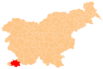
Močunigi (pronounced [mɔtʃuˈniːɡi]) is a small settlement in the City Municipality of Koper in the Littoral region of Slovenia.[2]
It lies right on the border with Croatia and is not connected by road to any surrounding settlements in Slovenia, only by a path to small villages on the Croatian side. It no longer has any permanent residents.[3]
History
In 1954, when the Free Territory of Trieste was dissolved and Zone B was assigned to Yugoslavia, Močunigi (together with Abitanti, Belvedur, Brezovica pri Gradinu, Gradin, Koromači–Boškini, Pregara, and Sirči) was originally assigned to the Socialist Republic of Croatia. In 1956 these villages were reassigned to the Socialist Republic of Slovenia.[4]
References
- ^ Statistical Office of the Republic of Slovenia
- ^ Koper municipal site
- ^ "Močunigi on Geopedia". Archived from the original on 2012-11-27. Retrieved 2012-11-27.
- ^ Aleš Gabrič (2018). "Ustvarjanje meje v jugoslovanski državi". In Zajc, Marko (ed.). Ustvarjanje slovensko-hrvaške meje. Ljubljana: Inštitut za novejšo zgodovino. p. 85.
External links
- Močunigi on Geopedia
- v
- t
- e
Administrative seat: Koper

| Koper |
|
|---|---|
| Elsewhere |
|
people
- Zvest Apollonio
- Gian Rinaldo Carli
- Vittore Carpaccio
- Boris Cavazza
- Giorgio Cobolli
- Lucija Čok
- Zlatko Dedić
- Lorella Flego
- Pier Antonio Quarantotti Gambini
- Lucrezio Gravisi
- Franco Juri
- Tinkara Kovač
- Igor Pribac
- Tomaž Šalamun
- Santorio Santorio
- Nazario Sauro
- Spartaco Schergat
- Francesco Trevisani
- Pier Paolo Vergerio
- Pier Paolo Vergerio the Elder
- Vittorio Italico Zupelli


