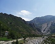
Mirditë District
 Albania
Mirditë District (Albanian: Rrethi i Mirditës) was one of the 36 districts of Albania, which were dissolved in July 2000 and replaced by 12 newly created counties. It had a population of 37,055 in 2001, and an area of 867 km2 (335 sq mi).[1] It is in the north of the country, and its capital was the town of Rrëshen. The district was located within the wider region of Mirdita, whose territory is synonymous with the historic Albanian tribe of the same name. The area of the former district is coextensive with the present municipality of Mirditë, which is part of Lezhë County.
Administrative divisions
The district consisted of the following municipalities:[2]
Note: - urban municipalities in bold
Gallery
-
 Zogu Bridge
 -
 Fan River Canyon
 -
 Fan Valley in Reps
 -
 Rubik Church on top left along A1 Highway
See also
- Republic of Mirdita
- Mirditë (municipality), municipality in Lezhë County
- Mirdita, region
References
- ^ Districts of Albania, statoids.com
- ^ "Portraits of poverty and inequality in Albania" (PDF). World Bank Group. 2016. pp. 33–40.
External links
- Mirdita Tourism Portal
- v
- t
- e
 | This article about a specific location in Lezhë County, Albania, is a stub. You can help Wikipedia by expanding it. |
- v
- t
- e


