Millingport, North Carolina
Unincorporated community in North Carolina, United States
35°22′51″N 80°18′18″W / 35.38083°N 80.30500°W / 35.38083; -80.30500 (2020)
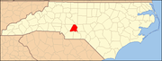
Millingport is an unincorporated community and census-designated place in Stanly County, North Carolina, United States. Its population was 599 as of the 2010 census.[3] North Carolina Highway 73 passes through the community.
Geography
According to the U.S. Census Bureau, the community has an area of 5.682 square miles (14.72 km2), all land.[3]
Demographics
| Census | Pop. | Note | %± |
|---|---|---|---|
| 2020 | 588 | — | |
| U.S. Decennial Census[4] | |||
References
- ^ "ArcGIS REST Services Directory". United States Census Bureau. Retrieved September 20, 2022.
- ^ "Millingport". Geographic Names Information System. United States Geological Survey, United States Department of the Interior.
- ^ a b "2010 Census Gazetteer Files - Places: North Carolina". U.S. Census Bureau. Retrieved February 26, 2017.
- ^ "Census of Population and Housing". Census.gov. Retrieved June 4, 2016.
- v
- t
- e
Municipalities and communities of Stanly County, North Carolina, United States
County seat: Albemarle
- Aquadale
- Millingport
communities
‡This populated place also has portions in an adjacent county or counties
- North Carolina portal
- United States portal
This article about a location in Stanly County, North Carolina is a stub. You can help Wikipedia by expanding it. |
- v
- t
- e


