Mahalakshmi Layout
Neighborhood in Bengaluru Urban, Karnataka, India
Mahalakshmi Layout Mahalakshmipuram | |
|---|---|
neighborhood | |
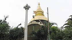 | |
| Nickname: Temple Layout | |
| 13°01′00″N 77°32′18″E / 13.01667°N 77.53833°E / 13.01667; 77.53833 | |
| Country | India |
| State | Karnataka |
| District | Bengaluru Urban |
| Metro | Bengaluru |
| Area | |
| • Total | 1.46756 km2 (0.56663 sq mi) |
| Languages | |
| • Official | Kannada |
| Time zone | UTC+5:30 (IST) |
| PIN | 560086 |
| Telephone code | 080 |
| Vehicle registration | KA 02 |
Mahalakshmi Layout, also known as Mahalakshmipuram is a neighborhood in northwest Bengaluru, India. It is near Rajajinagara, Basaveshwaranagara and Yeshwanthpura. Together with Nandini Layout, Kurubarahalli and Nagapura, it is one of the biggest residential areas in Bengaluru.
Educational institutions
Mahalakshmi layout has a considerable number of educational institutions, both at the primary/secondary education and higher education level.
The area consists of renowned colleges and colleges.
- BGS World School
- BGS Pre-university College
- BGS Institute of Management
- Orchids International School Mahalakshmi Layout
- Basaveshwara Aided High School
- Max Muller Public School
- St. Paul's High School
- SG International Public School

References
Areas of Bangalore | ||||||||||||||||
|---|---|---|---|---|---|---|---|---|---|---|---|---|---|---|---|---|
| ||||||||||||||||


- v
- t
- e
| Lakes |
|
|---|
administration
| Municipal elections | |||||
|---|---|---|---|---|---|
| Municipal Corporation |
|
- 100 Feet Road
- Avenue Road
- Bannerghatta Road (SH 87)
- Brigade Road
- Church Street
- Cunningham Road
- Hosur Road (NH 7)
- Inner Ring Road
- J C Road
- Kasturba Road
- Lavelle Road
- M.G. Road
- Mysore Road (SH 17)
- NICE Road
- Old Airport Road
- Outer Ring Road
- Peripheral Ring Road
- Tannery Road
worship
| Periodic events |
|---|
| Cinemas |
|---|
| Sports |
|---|
| Others |
|---|


