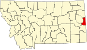
List of mountains in Wibaux County, Montana
Map all coordinates using OpenStreetMap
Download coordinates as:
- KML
- GPX (all coordinates)
- GPX (primary coordinates)
- GPX (secondary coordinates)
This list is incomplete; you can help by adding missing items. (February 2011) |
There are at least 11 named mountains in Wibaux County, Montana.
- Baird Butte, 48°53′54″N 104°11′15″W / 48.89833°N 104.18750°W / 48.89833; -104.18750 (Baird Butte), el. 2,946 feet (898 m)[1]
- Beehive, 47°18′34″N 104°13′18″W / 47.30944°N 104.22167°W / 47.30944; -104.22167 (Beehive), el. 2,451 feet (747 m)[2]
- Blue Mountain, 47°15′34″N 104°10′06″W / 47.25944°N 104.16833°W / 47.25944; -104.16833 (Blue Mountain), el. 2,881 feet (878 m)[3]
- Four Buttes, 47°06′08″N 104°12′00″W / 47.10222°N 104.20000°W / 47.10222; -104.20000 (Four Buttes), el. 2,802 feet (854 m)[4]
- Graveyard Hill, 48°46′18″N 104°31′31″W / 48.77167°N 104.52528°W / 48.77167; -104.52528 (Graveyard Hill), el. 2,697 feet (822 m)[5]
- Horse Point, 48°50′14″N 104°12′34″W / 48.83722°N 104.20944°W / 48.83722; -104.20944 (Horse Point), el. 2,904 feet (885 m)[6]
- Jackrabbit Butte, 48°51′35″N 104°09′22″W / 48.85972°N 104.15611°W / 48.85972; -104.15611 (Jackrabbit Butte), el. 2,946 feet (898 m)[7]
- Mount McKinley, 48°49′14″N 104°31′58″W / 48.82056°N 104.53278°W / 48.82056; -104.53278 (Mount McKinley), el. 2,674 feet (815 m)[8]
- Pine Hill, 48°46′36″N 104°35′18″W / 48.77667°N 104.58833°W / 48.77667; -104.58833 (Pine Hill), el. 2,828 feet (862 m)[9]
- Podolski Butte, 48°46′56″N 104°09′25″W / 48.78222°N 104.15694°W / 48.78222; -104.15694 (Podolski Butte), el. 3,068 feet (935 m)[10]
- Red Top Butte, 48°51′09″N 104°09′39″W / 48.85250°N 104.16083°W / 48.85250; -104.16083 (Red Top Butte), el. 3,074 feet (937 m)[11]
See also
Notes
- ^ "Baird Butte". Geographic Names Information System. United States Geological Survey, United States Department of the Interior.
- ^ "Beehive". Geographic Names Information System. United States Geological Survey, United States Department of the Interior.
- ^ "Blue Mountain". Geographic Names Information System. United States Geological Survey, United States Department of the Interior.
- ^ "Four Buttes". Geographic Names Information System. United States Geological Survey, United States Department of the Interior.
- ^ "Graveyard Hill". Geographic Names Information System. United States Geological Survey, United States Department of the Interior.
- ^ "Horse Point". Geographic Names Information System. United States Geological Survey, United States Department of the Interior.
- ^ "Jackrabbit Butte". Geographic Names Information System. United States Geological Survey, United States Department of the Interior.
- ^ "Mount McKinley". Geographic Names Information System. United States Geological Survey, United States Department of the Interior.
- ^ "Pine Hill". Geographic Names Information System. United States Geological Survey, United States Department of the Interior.
- ^ "Podolski Butte". Geographic Names Information System. United States Geological Survey, United States Department of the Interior.
- ^ "Red Top Butte". Geographic Names Information System. United States Geological Survey, United States Department of the Interior.