Lanham, Kansas and Nebraska
Unincorporated community in Kansas and Nebraska, US
Unincorporated community in the United States
40°0′10″N 96°52′26″W / 40.00278°N 96.87389°W / 40.00278; -96.87389[1]Gage, Nebraska
66945, 68415
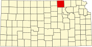
Lanham is an unincorporated community in both Washington County, Kansas, and Gage County, Nebraska, United States.[1] The Kansas–Nebraska state line runs down its main street.[2] It is located along State Line Road, about 0.6 miles west of K-148/Nebraska Highway 112.[3] Also, it is 7 miles north of Hanover, Kansas, and 6.5 miles from Odell, Nebraska.
History
Lanham was named for a railroad official.[4] A post office was opened in Lanham (on the Kansas side[4]) in 1914, and remained in operation until 1923.[5]
Education
The Kansas side of the border and nearby rural areas are served by Barnes–Hanover–Linn USD 223 public school district.
References
- ^ a b c d e "Lanham, Nebraska", Geographic Names Information System, United States Geological Survey, United States Department of the Interior
- ^ Brackman, Barbara (1997). Kansas Trivia. Thomas Nelson Inc. p. 10. ISBN 9781418553814.
- ^ Lanham Topo Map in Gage County NE
- ^ a b Fitzpatrick, Lillian L. (1960). Nebraska Place-Names. University of Nebraska Press. p. 65. ISBN 0803250606.
- ^ "Kansas Post Offices, 1828-1961". Kansas Historical Society. Archived from the original on October 9, 2013. Retrieved June 27, 2014.
Further reading
External links
Wikimedia Commons has media related to Populated places in Gage County, Nebraska.
- Washington County Kansas maps: Current, Historic, KDOT
- v
- t
- e
Municipalities and communities of Washington County, Kansas, United States
County seat: Washington
communities
- Lanham‡
- Barnes
- Brantford
- Charleston
- Clifton
- Coleman
- Farmington
- Franklin
- Grant
- Greenleaf
- Haddam
- Hanover
- Highland
- Independence
- Kimeo
- Lincoln
- Linn
- Little Blue
- Logan
- Lowe
- Mill Creek
- Sheridan
- Sherman
- Strawberry
- Union
- Washington
‡This community also has portions in an adjacent county or counties.
- Kansas portal
- United States portal
Municipalities and communities of Gage County, Nebraska, United States | ||
|---|---|---|
County seat: Beatrice | ||
| Cities |  | |
| Villages | ||
| Townships | ||
| CDP | ||
| Unincorporated communities | ||
| Footnotes | ‡This populated place also has portions in an adjacent state | |
| ||
 | This article about a location in Washington County, Kansas is a stub. You can help Wikipedia by expanding it. |
- v
- t
- e
 | This Gage County, Nebraska state location article is a stub. You can help Wikipedia by expanding it. |
- v
- t
- e


