Lafayette–New Iberia–Opelousas combined statistical area
Combined Statistical Area in Louisiana, United States
Lafayette metropolitan area Vermilionville | ||
|---|---|---|
Combined Statistical Area | ||
| Lafayette–New Iberia–Opelousas, La. Combined Statistical Area | ||
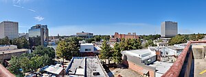 Lafayette Skyline (2021) | ||
 Seal | ||
| Nickname: Hub City | ||
 Map of Lafayette–New Iberia–Opelousas, LA CSA
| ||
| Country |  United States United States | |
| State |  Louisiana Louisiana | |
| Principal city | Lafayette | |
| Other cities | - Youngsville - Broussard - Opelousas - New Iberia | |
| Time zone | UTC-6 (CST) | |
| • Summer (DST) | UTC-5 (CDT) | |
| Website | http://www.lafayettela.gov/ | |
| Named for Gilbert du Motier, marquis de La Fayette | ||
The Lafayette–New Iberia–Opelousas combined statistical area is made up of six parishes in the Acadiana region of southern Louisiana. The statistical area consists of the Lafayette Metropolitan Statistical Area (MSA)[1] and two micropolitical statistical areas (μSAs)[2] – New Iberia, Louisiana Micropolitan Statistical Area, and Opelousas, Louisiana Micropolitical Statistical Area. The region consists of six parishes: Acadia, Iberia, Lafayette, St. Landry, St. Martin, and Vermilion Parishes. As of the 2020 census, the CSA had a population of 560,924 (though a 2023 estimate placed the population at 563,411).[3]
The CSA is home to a large Cajun population and is also known as the "Cajun heartland".[citation needed]
Demographics
As of the census[4] of 2010, there were 550,134 people, 188,219 households, and 134,322 families residing within the CSA. The racial makeup of the CSA was 70.42% White, 27.07% African American, 0.25% Native American, 1.01% Asian, 0.02% Pacific Islander, 0.40% from other races, and 0.84% from two or more races. Hispanic or Latino of any race were 1.35% of the population. Of the total population over the age of 5, 83.4% (419,800) spoke English and 12.7% (64,001) spoke French (including Cajun French and Louisiana Creole French).[5]
The median income for a household in the CSA was $29,577, and the median income for a family was $35,717. Males had a median income of $31,564 versus $18,942 for females. The per capita income for the CSA was $14,467.
Communities
Places with 20,000 people or more
- Lafayette (principal city)
- New Iberia
Places with 10,000 to 19,999 people
Places with 2,500 to 9,999 people
Places with fewer than 2,500 people
- Arnaudville
- Basile (mostly located in Evangeline Parish with small southern portion located in Acadia Parish)
- Branch
- Cade
- Catahoula
- Cankton
- Cecilia
- Delcambre
- Duson
- Erath
- Estherwood
- Grand Coteau
- Gueydan
- Henderson
- Iota
- Krotz Springs
- Lawtell
- Leonville
- Loreauville
- Lydia
- Maurice
- Melville
- Mermentau
- Morse
- Palmetto
- Parks
- Port Barre
- Washington
See also
- Louisiana census statistical areas
- List of cities, towns, and villages in Louisiana
- List of census-designated places in Louisiana
References
- ^ http://factfinder.census.gov/faces/tableservices/jsf/pages/productview.xhtml?pid=PEP_2015_GCTPEPANNR.US24PR&prodType=table Archived 2020-02-14 at archive.today Retrieved June 4, 2106
- ^ http://factfinder.census.gov/faces/tableservices/jsf/pages/productview.xhtml?pid=PEP_2015_GCTPEPANNR.US25PR&prodType=table Archived 2020-02-14 at archive.today Retrieved June 4, 2016
- ^ "Metropolitan and Micropolitan Statistical Areas Population Totals: 2020-2023". United States Census Bureau, Population Division. March 14, 2024. Retrieved March 16, 2024.
- ^ "U.S. Census website". United States Census Bureau. Retrieved 2008-01-31.
- ^ United States Census
- v
- t
- e
Baton Rouge (capital)
- Index
- Fauna
- History
- Music
- Louisianians
- Constitution
- Governors
- Hurricanes
- Legislature
- Supreme Court
- Congressional districts
- Symbols
- Tourist attractions
- Acadia
- Allen
- Ascension
- Assumption
- Avoyelles
- Beauregard
- Bienville
- Bossier
- Caddo
- Calcasieu
- Caldwell
- Cameron
- Catahoula
- Claiborne
- Concordia
- DeSoto
- East Baton Rouge
- East Carroll
- East Feliciana
- Evangeline
- Franklin
- Grant
- Iberia
- Iberville
- Jackson
- Jefferson
- Jefferson Davis
- Lafayette
- Lafourche
- LaSalle
- Lincoln
- Livingston
- Madison
- Morehouse
- Natchitoches
- Orleans
- Ouachita
- Plaquemines
- Pointe Coupee
- Rapides
- Red River
- Richland
- Sabine
- St. Bernard
- St. Charles
- St. Helena
- St. James
- St. John the Baptist
- St. Landry
- St. Martin
- St. Mary
- St. Tammany
- Tangipahoa
- Tensas
- Terrebonne
- Union
- Vermilion
- Vernon
- Washington
- Webster
- West Baton Rouge
- West Carroll
- West Feliciana
- Winn
 Louisiana portal
30°00′N 91°54′W / 30°N 91.9°W / 30; -91.9


