Kletsel Dehe Wintun Nation of the Cortina Rancheria
Native American tribe
Ethnic group
 General location of the Cortina Rancheria | |
| Total population | |
|---|---|
| 117 enrolled members, 19 rancheria residents[1] | |
| Regions with significant populations | |
| Colusa County, California | |
| Languages | |
| English, formerly Wintu | |
| Related ethnic groups | |
| Wintun (Nomlaki and Patwin), Yokuts |
The Kletsel Dehe Wintun Nation of the Cortina Rancheria is a federally recognized tribe of Indigenous people of California.[2] They are Wintun people, who historically spoke Wintuan languages.
They're headquartered in Williams, California,[2] and they have approximately 270 enrolled citizens.[1] They were previously known as the Kletsel Dehe Band of Wintun Indians, Cortina Indian Rancheria, and Cortina Indian Rancheria of Wintun Indians of California.[3]
Government
Charlie Wright serves as their chairperson.[2][4]
Rancheria
The Cortina Rancheria is an Indian reservation in Colusa County, California, at an elevation of 1,312 feet (400 m). The rancheria is 640 acres large in area.[1] It is located about 70 miles northwest of Sacramento[1] and 15 miles west of Arbuckle, California. As of the 2010 Census the population was 21.[5]
Activities
The tribe partnered with California State University, Chico, to study water quality and purification systems.[6]
See also
- Waikosel, California
- Wintu-Nomlaki traditional narratives
References
- ^ a b c d "Cortina Indian Rancheria". California Indians and Their Reservations: An Online Dictionary. San Diego State University. Retrieved February 6, 2023.
- ^ a b c "Kletsel Dehe Wintun Nation of the Cortina Rancheria". Indian Affairs. U.S. Department of the Interior. Retrieved February 6, 2023.
- ^ "Kletsel Dehe Wintun Nation of the Cortina Rancheria". National Indian Law Library. Retrieved February 6, 2023.
- ^ "Federally Recognized Tribal Contact Information". California Governor's Office of Tribal Affairs. Retrieved February 6, 2023.
- ^ https://www.census.gov/2010census/popmap/ipmtext.php?fl=0780[permanent dead link]
- ^ "Kletsel Dehe Wintun Nation Partners with Local University on Water Quality Initiatives". US Environmental Protection Agency. Retrieved February 6, 2023.
External links
39°01′06″N 122°17′25″W / 39.01833°N 122.29028°W / 39.01833; -122.29028
- Kletsel Dehe Wintun Nation, official website
- U.S. Geological Survey Geographic Names Information System: Kletsel Dehe Wintun Nation of the Cortina Rancheria
- Cortina Rancheria Band of Wintun Indians
- v
- t
- e
 Indian reservations and Rancherías in California
and Colonies
- Agua Caliente
- Barona
- Benton Paiute
- Big Pine
- Bishop
- Bridgeport
- Campo
- Capitan Grande
- Chemehuevi
- Colorado River
- Colusa
- Coyote Valley
- Death Valley
- Elem
- Ewiiaapaayp
- Fort Bidwell
- Fort Independence
- Fort Mojave
- Fort Yuma
- Hoopa Valley
- Inaja and Cosmit
- Jamul Indian Village
- La Jolla
- La Posta
- Lone Pine
- Los Coyotes
- Manzanita
- Mendocino
- Mesa Grande
- Morongo
- Pala
- Pauma and Yuima
- Pechanga
- Quartz Valley
- Rincon
- Round Valley
- San Manuel
- San Pasqual
- Santa Rosa
- Santa Ynez
- Santa Ysabel
- Sebastian
- Smith River
- Sycuan
- Tejon
- Tule River
- Viejas
- Washoe
- Wiyot
- Yurok
- Alturas
- Auburn
- Berry Creek
- Big Bend
- Big Lagoon
- Big Sandy
- Big Valley
- Blue Lake
- Buena Vista
- Cedarville
- Chicken Ranch
- Chico
- Cloverdale
- Cold Springs
- Cortina
- Dry Creek
- Elk Valley
- Enterprise
- Graton
- Greenville
- Grindstone
- Jackson
- Laytonville
- Likely
- Lookout
- Lower Lake
- Lytton
- Manchester-Point Arena
- Middletown
- Montgomery Creek
- Mooretown
- Northfork
- Paskenta
- Picayune
- Redwood Valley
- Redding
- Resighini
- Roaring Creek
- Robinson
- Rohnerville
- Rumsey
- Santa Rosa
- Sheep Ranch
- Shingle Springs
- Smith River
- Stewarts Point
- Susanville
- Trinidad
- Upper Lake
- Wilton
- XL Ranch
Municipalities and communities of Colusa County, California, United States | ||
|---|---|---|
County seat: Colusa | ||
| Cities | 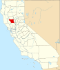 | |
| CDPs | ||
| Unincorporated communities | ||
| Indian reservations |
| |
| Ghost towns | ||
| Footnotes | ‡This populated place also has portions in an adjacent county or counties | |
| ||
Authority control databases | |
|---|---|
| International |
|
| National |
|


