Indre Sula
![Map of the location](http://upload.wikimedia.org/wikipedia/commons/thumb/1/1c/Norway_M%C3%B8re_og_Romsdal_rel_location_map.svg/272px-Norway_M%C3%B8re_og_Romsdal_rel_location_map.svg.png)
![Map of the location](http://upload.wikimedia.org/wikipedia/en/thumb/3/39/Red_triangle_with_thick_white_border.svg/16px-Red_triangle_with_thick_white_border.svg.png)
Indre Sula
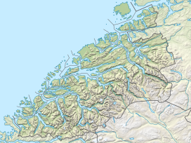
Location of the mountain
Show map of Møre og Romsdal![Map of the location](http://upload.wikimedia.org/wikipedia/commons/thumb/e/eb/Relief_Map_of_Norway.png/272px-Relief_Map_of_Norway.png)
![Map of the location](http://upload.wikimedia.org/wikipedia/en/thumb/3/39/Red_triangle_with_thick_white_border.svg/16px-Red_triangle_with_thick_white_border.svg.png)
Indre Sula
Indre Sula (Norway)
Show map of NorwayIndre Sula is a mountain in the municipality of Surnadal in Møre og Romsdal county, Norway.[2] It is part of the Trollheimen mountain range, and it lies just north of the village of Todalsøra and the Todalsfjorden.
Indre Sula, meaning "Inner Sula", lies next to Ytre Sula, meaning "Outer Sula". The route from Indre Sula to Ytre Sula is scrambling.
References
- v
- t
- e