Imeľ
Village in Slovakia
Imeľ Imely | |
|---|---|
Village | |
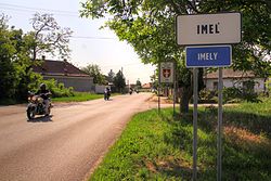 Entering the village | |
 Coat of arms | |
| 47°54′N 18°09′E / 47.900°N 18.150°E / 47.900; 18.150 | |
| Country | Slovakia |
| Region | Nitra |
| District | Komárno |
| First mentioned | 1404 |
| Area | |
| • Total | 21.95[2] km2 (8.47[2] sq mi) |
| Elevation | 111[3] m (364[3] ft) |
| Population (2021) | |
| • Total | 1,972[1] |
| Postal code | 946 52[3] |
| Area code | +421 35[3] |
| Car plate | KN |
| Website | www.obecimel.sk |
Imeľ (Hungarian: Imely, Hungarian pronunciation:[ˈiːmɛj]) is a village and municipality in the Komárno District in the Nitra Region of southwest Slovakia.
History
In historical records the village was first mentioned in 1404. It was sacked by Ottoman troops in 1561. It was also managed by Ottoman Empire during periods of 1566-1595, 1605-1606 and 1663-1685. It was recorded as "Imo" as part of Komaran nahiya in Estergon sanjak of Budin Eyalet in 1664 Ottoman record. It had 45 homes and 12470 akches of tax was collected.
After the Austro-Hungarian army disintegrated in November 1918, Czechoslovak troops occupied the area, later acknowledged internationally by the Treaty of Trianon. Between 1938 and 1945 Imeľ once more became part of Miklós Horthy's Hungary through the First Vienna Award. From 1945 until the Velvet Divorce, it was part of Czechoslovakia. Since then it has been part of Slovakia.
Geography
The village lies at an altitude of 111 metres and covers an area of 21.96 km².
Population
According to the 2011 census, the municipality had 2,054 inhabitants. 1,125 of inhabitants were Slovaks, 878 Hungarians and 51 others and unspecified.[5]
Facilities
The village has a public library, a gym and a football pitch. It also has a cinema.
See also
References
- ^ "Počet obyvateľov podľa pohlavia - obce (ročne)". www.statistics.sk (in Slovak). Statistical Office of the Slovak Republic. 2022-03-31. Retrieved 2022-03-31.
- ^ a b "Hustota obyvateľstva - obce [om7014rr_ukaz: Rozloha (Štvorcový meter)]". www.statistics.sk (in Slovak). Statistical Office of the Slovak Republic. 2022-03-31. Retrieved 2022-03-31.
- ^ a b c d "Základná charakteristika". www.statistics.sk (in Slovak). Statistical Office of the Slovak Republic. 2015-04-17. Retrieved 2022-03-31.
- ^ a b "Hustota obyvateľstva - obce". www.statistics.sk (in Slovak). Statistical Office of the Slovak Republic. 2022-03-31. Retrieved 2022-03-31.
- ^ "Archived copy" (PDF). Archived from the original (PDF) on November 14, 2012. Retrieved August 10, 2012.
{{cite web}}: CS1 maint: archived copy as title (link)
Genealogical resources
The records for genealogical research are available at the state archive "Statny Archiv in Nitra, Slovakia"
- Roman Catholic church records (births/marriages/deaths): 1705-1895 (parish A)
- Reformated church records (births/marriages/deaths): 1786-1936 (parish B)
External links
- http://www.obecimel.sk
- Surnames of living people in Imel
- v
- t
- e
Municipalities of Komárno District

- Bajč
- Bátorove Kosihy
- Bodza
- Bodzianske Lúky
- Brestovec
- Búč
- Čalovec
- Číčov
- Dedina Mládeže
- Dulovce
- Holiare
- Chotín
- Imeľ
- Iža
- Kameničná
- Klížska Nemá
- Kravany nad Dunajom
- Lipové
- Marcelová
- Martovce
- Moča
- Modrany
- Mudroňovo
- Okoličná na Ostrove
- Patince
- Pribeta
- Radvaň nad Dunajom
- Sokolce
- Svätý Peter
- Šrobárová
- Tôň
- Trávnik
- Veľké Kosihy
- Virt
- Vrbová nad Váhom
- Zemianska Olča
- Zlatná na Ostrove
 | This Nitra Region geography article is a stub. You can help Wikipedia by expanding it. |
- v
- t
- e


