Humboldt–Toiyabe National Forest
National forest in Nevada and California, United States
39°15′15″N 117°07′40″W / 39.254041°N 117.127767°W / 39.254041; -117.127767
Interactive map of Toiyabe National Forest
The Humboldt–Toiyabe National Forest (HTNF) is the principal U.S. National Forest in the U.S. state of Nevada, and has a smaller portion in Eastern California. With an area of 6,289,821 acres (25,454.00 km2), it is the largest U.S. National Forest outside of Alaska.
History
The lands now part of Humboldt-Toiyabe have been administratively reorganized many times, and include parts of several defunct national forests. The oldest of these is Ruby Mountains National Forest, established on May 3, 1906. In 1908, it was combined with Independence National Forest to form Humboldt National Forest. Toiyabe National Forest was established March 2, 1907. It ceased to exist in 1932, when it was absorbed by Nevada National Forest, but was reestablished in 1938 from parts of Humboldt and Nevada. The last major reorganization occurred on October 1, 1957, when Nevada National Forest was dissolved and its lands divided between Humboldt and Toiyabe.[3]
Humboldt and Toiyabe National Forests were administratively joined in 1995. Though managed as a single entity, the two forests remain legally and geographically distinct.[4]
Geography

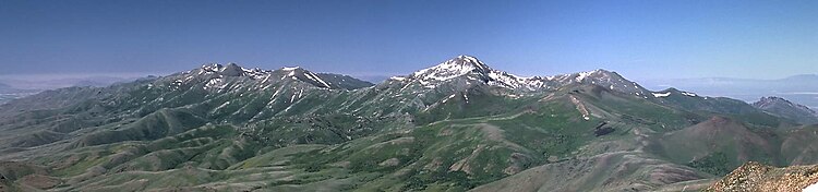
HTNF is unlike most other national forests as it contains numerous non-contiguous sections scattered across most of the state of Nevada and a portion of eastern California. Seven ranger districts are located in the many mountain ranges in Nevada, from the Santa Rosa Range in the north to the Spring Mountains near Las Vegas in the south. About 11% of the forest is in eastern California, in the areas around Bridgeport and Markleeville, and other areas east of the Sierra Nevada.
The forest lies in 13 counties in Nevada and six in California. The counties with the largest amount of forest land are Nye, Elko, and White Pine in Nevada, and Mono County in California, but there are 15 other counties with land in this widely dispersed forest. Forest headquarters are located in Sparks, Nevada.
Humboldt National Forest section
The smaller and more northeasterly Humboldt National Forest is located in eastern and northern Nevada, in parts of Elko, White Pine, Humboldt, Nye, and Lincoln counties. The section is named after Alexander von Humboldt, a nineteenth-century Prussian scientist,[5] and contains about 43.5% of the total area. Local ranger district offices are located in Ely, Elko, Wells, and Winnemucca.
Toiyabe National Forest section
The larger and more southwesterly Toiyabe National Forest is located in central, western, and southern Nevada and eastern California, in parts of Nye, Lander, Mineral, Lyon, Eureka, Washoe, Douglas, and Clark counties, and Carson City in Nevada, as well as Mono, Alpine, Sierra, Nevada, Lassen, and El Dorado counties in California. Toiyabe is a Native American name.[6] The section contains about 56.5% of the total area. Local ranger district offices are located in Austin, Bridgeport, Carson City, Las Vegas, and Tonopah. Bridgeport is the only station that is in California.
Ranger Districts

- Austin Ranger District – around Austin, including Shoshone Mountains
- Bridgeport Ranger District – around Bridgeport
- Carson Ranger District – near Carson City
- Ely Ranger District – around Ely, Nevada
- Jarbidge Ranger District – near Jarbidge
- Mountain City Ranger District – near Mountain City
- Ruby Mountains Ranger District – Ruby Mountains and East Humboldt Range
- (formerly Ruby Mountains National Forest)
- Spring Mountains National Recreation Area – Spring Mountains
- Santa Rosa Ranger District – Santa Rosa Range
- Tonopah Ranger District – near Tonopah, Nevada, including Toiyabe Range, Toquima Range, Monitor Range, and Hot Creek Range
Wilderness areas

Humboldt National Forest

- Bald Mountain Wilderness
- Currant Mountain Wilderness
- East Humboldt Wilderness
- Grant Range Wilderness
- High Schells Wilderness
- Jarbidge Wilderness
- Mount Moriah Wilderness (partly BLM)
- Quinn Canyon Wilderness
- Red Mountain Wilderness
- Ruby Mountains Wilderness
- Santa Rosa–Paradise Peak Wilderness
- Shellback Wilderness
- White Pine Range Wilderness
Toiyabe National Forest
- Alta Toquima Wilderness
- Arc Dome Wilderness
- Carson–Iceberg Wilderness (partly in Stanislaus NF)
- Hoover Wilderness (partly in Inyo NF)
- La Madre Mountain Wilderness (mostly BLM)
- Mokelumne Wilderness (mostly in Eldorado NF and partly in Stanislaus NF)[7]
- Mount Charleston Wilderness (partly BLM)
- Mount Rose Wilderness
- Rainbow Mountain Wilderness (mostly BLM)
- Table Mountain Wilderness
Counties

In descending order of forest land area within the counties:[8]
Nevada counties
- Nye, Elko, White Pine, Lander, Humboldt, Mineral, Lyon, Eureka, Washoe, Douglas, Clark, Lincoln, Carson City
California counties
References
 Nevada portal

- ^ "Humboldt–Toiyabe National Forest". U.S. Department of Agriculture. June 2014. Retrieved June 10, 2014.
- ^ "Land Areas of the National Forest System" (PDF). U.S. Forest Service. November 2014. Retrieved August 9, 2015.
- ^ Davis, Richard C., ed. (1983). "Appendix I: The National Forests of the United States" (PDF). Encyclopedia of American Forest and Conservation History, Vol. II. New York: Macmillan Publishing Company for the Forest History Society.
- ^ Richa, Wilson (24 Dec 2009), History of the Toiyabe National Forest (PDF)
- ^ "Humboldt–Toiyabe National Forest Visitor Guide". fs.usda.gov. United States Department of Agriculture, Forest Service. p. 2. Retrieved July 17, 2019.
- ^ "Friends of Nevada Wilderness".
- ^ "Acreage breakdown". Wilderness.net. Archived from the original on 2012-06-30. Retrieved 2013-12-28.
- ^ "Table 6 - NFS Acreage by State, Congressional District and County". fs.fed.us. 10 Oct 2007. Archived from the original on 2022-03-10. Retrieved 24 Sep 2023.
External links
Wikimedia Commons has media related to Humboldt–Toiyabe National Forest.
- Official website
- National Atlas: Map of Humboldt–Toiyabe National Forest
- v
- t
- e
| Peaks >14,000 ft |
|  |
|---|---|---|
| Northern peaks |
| |
| Central peaks | ||
| Southern peaks | ||
| Climbing |
|
- Tahoe
- Aloha
- Echo
- Fallen Leaf
- Spooner
- Mono
- Almanor
- Oroville
- Isabella
- Donner
- Independence
- Shaver
- Huntington
- Florence
- Edison
- Wishon
- Courtright
- Tenaya
- Mammoth
- Bass
- Crowley
- Convict
- Hell for Sure
areas
| National parks and monuments | |
|---|---|
| National forests |
|
| Wilderness areas | |
| State parks |

| Authority control databases |
|
|---|


