Haninge Municipality
Municipality in Stockholm County, Sweden
Haninge Municipality Haninge kommun | |
|---|---|
Municipality | |
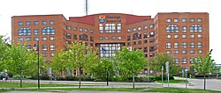 Haninge City Hall | |
 Coat of arms | |
 | |
Coordinates:
| |
| Time zone | UTC+1 (CET) |
| • Summer (DST) | UTC+2 (CEST) |
| ISO 3166 code | SE |
| Province | Södermanland |
| Municipal code | 0136 |
| Website | www.haninge.se |
| Density is calculated using land area only. | |
Haninge Municipality (Haninge kommun) is a municipality in Stockholm County in east central Sweden. Its seat is located in Handen, a part of the Stockholm urban area.
Haninge Municipality was formed in 1971 when Västerhaninge and Österhaninge were united.
The municipal coat of arms depicts a capercaillie from which the name Haninge is believed to have been derived (the German word hahn means capercaillie), while the anchor symbolizes the naval base in the municipality. The German word usage is supposedly from the old German Hansa traders who operated in the area.
Geography

Haninge cherishes its nature, housing the southern parts of the scenic Stockholm archipelago. There are over 3,600 islands, islets and skerries belonging to the municipality, with the three largest islands being Utö, Ornö and Muskö. A car tunnel, the third longest in Sweden, connects Muskö to the mainland. The other two of the islands are reached with passenger and car ferries. Haninge is also an area with access to Tyresta National Park with a surrounding nature reserve. It has been protected to preserve its noted natural values, e.g. one of the largest sections of untouched forest in southern Sweden.
Localities
- Dalarö
- Stockholm (part of)
- Jordbro
- Muskö
- Västerhaninge
Districts
- Brandbergen
- Dalarö
- Handen
- Jordbro
- Norrby [sv]
- Sågen
- Vega
- Vendelsö-Gudö [sv]
- Vendelsömalm
- Västerhaninge
- Tungelsta [sv]
Demographics
Population
| Year | Population | ||||||||
|---|---|---|---|---|---|---|---|---|---|
| 1970 | 45,001 | ||||||||
| 1975 | 50,295 | ||||||||
| 1980 | 58,541 | ||||||||
| 1985 | 61,166 | ||||||||
| 1990 | 62,797 | ||||||||
| 1995 | 65,706 | ||||||||
| 2000 | 69,644 | ||||||||
| 2005 | 71,837 | ||||||||
| 2010 | 77,054 | ||||||||
| 2015 | 83,866 | ||||||||
| 2017 | 88,037 | ||||||||
| 2019 | 92,095 | ||||||||
| Source: SCB - Folkmängd efter region och år. | |||||||||
2022 by district
This is a demographic table based on Haninge Municipality's electoral districts in the 2022 Swedish general election sourced from SVT's election platform, in turn taken from SCB official statistics.[3]
In total there were 95,449 residents, including 64,640 Swedish citizens of voting age.[3] 46.2% voted for the left coalition and 51.7% for the right coalition. Indicators are in percentage points except population totals and income.
| Location | Residents | Citizen adults | Left vote | Right vote | Employed | Swedish parents | Foreign heritage | Income SEK | Degree |
|---|---|---|---|---|---|---|---|---|---|
| % | % | ||||||||
| 1 Gudö | 2,050 | 1,417 | 40.1 | 58.5 | 89 | 84 | 16 | 37,004 | 47 |
| 2 Vendelsö-Norrby | 2,887 | 1,994 | 41.5 | 57.9 | 86 | 86 | 14 | 35,277 | 47 |
| 3 Söderby | 1,946 | 1,376 | 44.2 | 54.4 | 87 | 80 | 20 | 31,333 | 37 |
| 4 Vega-Söderhagen | 2,253 | 1,535 | 38.6 | 59.6 | 85 | 76 | 24 | 34,343 | 43 |
| 5 Sågen-Lyckebyn | 2,166 | 1,542 | 43.8 | 54.3 | 82 | 76 | 24 | 28,850 | 38 |
| 6 Källtorp | 1,865 | 1,393 | 43.5 | 54.9 | 87 | 85 | 15 | 31,973 | 39 |
| 7 Vendelsömalm N | 2,124 | 1,554 | 43.9 | 55.1 | 86 | 79 | 21 | 30,353 | 37 |
| 8 Vendelsömalm-Ramsdalen | 1,382 | 1,014 | 43.4 | 55.9 | 87 | 83 | 17 | 32,200 | 44 |
| 9 Svartbäcken | 1,700 | 1,212 | 44.0 | 55.2 | 91 | 85 | 15 | 32,294 | 41 |
| 10 Vendelsömalm | 1,568 | 1,169 | 40.1 | 58.7 | 88 | 75 | 25 | 28,711 | 33 |
| 11 Kolartorp-Hermanstorp | 3,044 | 1,853 | 41.1 | 56.7 | 84 | 66 | 34 | 31,121 | 42 |
| 12 Vendelsömalm S | 2,071 | 1,492 | 47.0 | 51.1 | 80 | 59 | 41 | 24,592 | 31 |
| 13 Brandbergen NÖ | 2,764 | 1,492 | 57.1 | 39.4 | 71 | 36 | 64 | 21,245 | 23 |
| 14 Brandbergen SÖ | 2,176 | 1,365 | 54.6 | 41.8 | 74 | 40 | 60 | 22,117 | 29 |
| 15 Vendelsö | 1,544 | 1,047 | 41.2 | 57.7 | 88 | 87 | 13 | 37,475 | 50 |
| 16 Brandbergen V | 1,698 | 978 | 54.0 | 43.2 | 75 | 32 | 68 | 22,635 | 35 |
| 17 Brandbergen N | 1,846 | 966 | 56.5 | 37.6 | 65 | 28 | 72 | 18,753 | 22 |
| 18 Brandbergen S | 1,950 | 1,297 | 51.4 | 44.7 | 80 | 42 | 58 | 25,095 | 31 |
| 19 Handen N | 932 | 681 | 45.3 | 52.8 | 75 | 60 | 40 | 28,372 | 35 |
| 20 Handen C | 2,272 | 1,787 | 55.2 | 41.9 | 74 | 57 | 43 | 22,528 | 30 |
| 21 Söderbymalm | 1,322 | 944 | 52.7 | 45.1 | 78 | 53 | 47 | 24,885 | 35 |
| 22 Vega S | 1,980 | 1,438 | 46.5 | 51.9 | 92 | 66 | 34 | 33,194 | 53 |
| 23 Poseidon | 1,486 | 1,149 | 53.6 | 43.4 | 79 | 54 | 46 | 25,252 | 36 |
| 24 Kvarntorp | 1,864 | 1,607 | 40.1 | 58.6 | 87 | 66 | 34 | 30,881 | 44 |
| 25 Parkvägsområdet | 1,541 | 1,260 | 54.7 | 43.5 | 77 | 56 | 44 | 23,969 | 30 |
| 31 Jordbro NÖ | 1,952 | 964 | 63.9 | 31.4 | 67 | 18 | 82 | 19,062 | 27 |
| 32 Jordbro V | 2,248 | 1,216 | 70.0 | 23.8 | 63 | 18 | 82 | 16,610 | 22 |
| 33 Jordbro SV | 2,602 | 1,268 | 63.8 | 30.4 | 67 | 18 | 82 | 19,020 | 25 |
| 34 Jordbro SÖ | 2,153 | 1,075 | 65.8 | 30.8 | 66 | 21 | 79 | 19,479 | 26 |
| 37 Dalarö | 2,091 | 1,676 | 33.5 | 65.5 | 80 | 90 | 10 | 30,398 | 42 |
| 40 Krogtäppan-Sommarbo | 1,241 | 844 | 53.3 | 44.1 | 82 | 51 | 49 | 27,596 | 36 |
| 44 Handen S | 2,613 | 1,716 | 55.4 | 41.2 | 76 | 48 | 52 | 24,393 | 36 |
| 45 Vallaområdet V | 1,322 | 868 | 53.4 | 43.9 | 77 | 46 | 54 | 24,521 | 30 |
| 46 Vallaområdet Ö | 2,142 | 1,338 | 49.2 | 46.9 | 77 | 43 | 57 | 24,320 | 28 |
| 47 Slätmossen | 1,990 | 1,589 | 56.3 | 40.1 | 75 | 65 | 35 | 23,680 | 41 |
| 48 Jordbro N-Dåntorp | 1,497 | 1,080 | 56.6 | 39.7 | 79 | 52 | 48 | 25,843 | 29 |
| 49 Hammarängen | 1,732 | 1,246 | 35.1 | 63.7 | 85 | 82 | 18 | 30,867 | 30 |
| 50 Tungelsta | 1,737 | 1,246 | 36.7 | 61.8 | 80 | 79 | 21 | 28,687 | 31 |
| 51 Jägartorp-Sågen | 2,400 | 1,653 | 45.2 | 53.0 | 82 | 72 | 28 | 28,239 | 35 |
| 52 Skogs-Ekeby | 2,041 | 1,418 | 34.9 | 63.7 | 83 | 76 | 24 | 30,548 | 31 |
| 53 Åbylund | 2,421 | 1,562 | 48.2 | 50.2 | 76 | 58 | 42 | 23,714 | 27 |
| 54 Åby | 2,073 | 1,341 | 46.8 | 50.7 | 73 | 49 | 51 | 22,524 | 31 |
| 55 Västerhaninge | 2,847 | 1,964 | 42.5 | 55.5 | 86 | 80 | 20 | 30,981 | 42 |
| 56 Ribby-Öhaninge | 1,293 | 942 | 37.1 | 61.2 | 84 | 72 | 28 | 29,579 | 37 |
| 57 Ribbyberg | 2,007 | 1,253 | 42.3 | 55.6 | 84 | 69 | 31 | 27,006 | 32 |
| 58 Västerhaninge-Skärgård | 1,764 | 1,388 | 40.2 | 58.5 | 81 | 86 | 14 | 28,096 | 32 |
| 59 Tungelsta-Utlida | 2,523 | 1,833 | 36.1 | 62.3 | 85 | 81 | 19 | 29,118 | 29 |
| 60 Muskö | 758 | 616 | 40.2 | 58.7 | 78 | 88 | 12 | 25,762 | 27 |
| 61 Västerhaninge Ö | 1,571 | 982 | 46.9 | 51.3 | 82 | 54 | 46 | 25,234 | 35 |
| Source: SVT[3] | |||||||||
Residents with a foreign background
On 31 December 2017 the number of people with a foreign background (persons born outside of Sweden or with two parents born outside Sweden) was 31 107, or 35.33% of the population (88 037 on 31 December 2017). On 31 December 2002 the number of residents with a foreign background was (per the same definition) 17 323, or 24.43% of the population (70 902 on 31 December 2002).[4] On 31 December 2017 there were 88 037 residents in Haninge, of which 23 203 people (26.36%) were born in a country other than Sweden. Divided by country in the table below – the Nordic countries, as well as the 12 most common countries of birth outside of Sweden for Swedish residents, have been included, with other countries of birth bundled together by continent by Statistics Sweden.[5]
| Country of birth[5] | ||
|---|---|---|
| 31 December 2017 | ||
| 1 |  Sweden Sweden | 64,834 |
| 2 |  Poland Poland | 3,181 |
| 3 |  European Union: Other countries European Union: Other countries | 2,795 |
| 4 | Asia: Other countries | 2,442 |
| 5 |  Finland Finland | 2,161 |
| 6 | South America | 1,892 |
| 7 |  Turkey Turkey | 1,702 |
| 8 | Africa: Other countries | 1,665 |
| 9 | Europe outside of the EU: other countries | 1,058 |
| 10 |  Iraq Iraq | 909 |
| 11 |  Iran Iran | 770 |
| 12 |  Syria Syria | 756 |
| 13 |  Yugoslavia/ Yugoslavia Yugoslavia/ YugoslaviaSFR Yugoslavia/  Serbia and Montenegro Serbia and Montenegro | 588 |
| 14 | North America | 504 |
| 15 |  Afghanistan Afghanistan | 490 |
| 16 |  Thailand Thailand | 480 |
| 17 |  Bosnia and Herzegovina Bosnia and Herzegovina | 479 |
| 18 |  Germany Germany | 339 |
| 19 |  Somalia Somalia | 331 |
| 20 | 215 | |
| 21 |  Eritrea Eritrea | 164 |
| 22 |  Denmark Denmark | 123 |
| 23 |  Soviet Union Soviet Union | 75 |
| 24 | Oceania | 40 |
| 25 | 29 | |
| 26 | Unknown country of birth | 15 |
Notability
The scenic Stockholm Sweden Temple was built in Västerhaninge in 1985. It is the only temple of the Church of Jesus Christ of Latter-day Saints in Sweden. This temple is also the center of the LDS church in northern Europe.
There is a comparatively large Sweden-Finn community in Haninge which is estimated to be about 5% of the population.
The International Olympiad in Informatics (IOI) was held in Haninge in 1994.
Sports
The following sports clubs are located in Haninge Municipality:
- IFK Haninge/Brandbergen
- Haga Haninge Basket
- Vendelsö IK
- Haninge Anchors
- Haninge FBC
Notable people from Haninge Municipality
- William Eklund (*2002), professional ice hockey player
- Kristian Huselius (*1978), professional ice hockey player
- Mattias Löw (*1970), film director and photographer
- Stefan Nystrand (*1981), freestyle swimmer
- Per Yngve Ohlin (*1969), vocalist
- Adam Pålsson (* 1988), actor
- Fredrik Reinfeldt (*1965), Prime Minister of Sweden from 17 September 2006 to 14 September 2014.
- Sarah Sjöström (*1993), freestyle swimmer
- Sara Skyttedal (*1986), Member of the European Parliament for Sweden
- Meeri Wasberg (*1973), politician
International relations
The municipality is twinned with:[6]
- Ishøj Municipality, Denmark
- Haapsalu, Estonia
- Pargas, Finland
- Formia, Italy
- Krokom Municipality, Sweden
- Gračanica, Bosnia and Herzegovina
See also
References
- ^ "Statistiska centralbyrån, Kommunarealer den 1 januari 2014" (in Swedish). Statistics Sweden. 1 January 2014. Archived from the original (Microsoft Excel) on 27 September 2016. Retrieved 18 April 2014.
- ^ "Folkmängd och befolkningsförändringar - Kvartal 4, 2023" (in Swedish). Statistics Sweden. 22 February 2024. Retrieved 22 February 2024.
- ^ a b c "Valresultat 2022 för Haninge i riksdagsvalet" (in Swedish). SVT. 11 September 2022. Retrieved 3 February 2024.
- ^ Antal personer efter region, utländsk/svensk bakgrund och år (Read 4 januari 2019)
- ^ a b Statistiska centralbyrån: Utrikes födda efter län, kommun och födelseland 31 december 2017 (XLS-fil) Läst 4 januari 2019
- ^ "Startsida – Haninge Kommun". Archived from the original on 21 August 2010. Retrieved 18 January 2010.
External links
Wikimedia Commons has media related to Haninge Municipality.
- Haninge Municipality – Official site
Places adjacent to Haninge Municipality | ||||||||||||||||
|---|---|---|---|---|---|---|---|---|---|---|---|---|---|---|---|---|
| ||||||||||||||||


Municipalities and seats of Stockholm County | ||
|---|---|---|
| Municipalities |  | |
| Municipal seats | ||
Authority control databases | |
|---|---|
| International |
|
| National |
|
| Geographic |
|


