Hammond, Montana
Unincorporated community in Montana, United States
45°13′32″N 104°55′05″W / 45.22556°N 104.91806°W / 45.22556; -104.9180659332[2]
Hammond is an unincorporated community in Carter County, Montana, United States.[1] It is located approximately 30 miles (48 km) southeast of the town of Broadus along U.S. Highway 212. Its elevation is 3,711 feet.
History
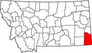
The town began with a store and gas station during the construction of US 212 in the 1930s.[3] In the 21st century, Hammond has consisted only of an active post office and a rancher's home. Three other buildings along the highway are abandoned and deteriorated beyond use. Hammond is located in the southeast corner of the state, near the Montana-Wyoming border between the unincorporated communities of Boyes and Alzada in Carter County. Hammond is 61 miles (98 km) southwest of the Carter County seat, Ekalaka. The area around Hammond is mostly ranchland.[4]
Climate
According to the Köppen Climate Classification system, Hammond has a semi-arid climate, abbreviated "BSk" on climate maps.[5]
References
- ^ a b c U.S. Geological Survey Geographic Names Information System: Hammond, Montana
- ^ "Hammond ZIP Code". zipdatamaps.com. 2022. Retrieved November 11, 2022.
- ^ "Hammond". Montana Place Names Companion. Montana Historical Society. Retrieved April 5, 2021.
- ^ "Hammond".
- ^ Climate Summary for Alzada, Montana
- v
- t
- e
Municipalities and communities of Carter County, Montana, United States
County seat: Ekalaka
communities
‡This populated place also has portions in an adjacent county or counties
- Montana portal
- United States portal
 | This Carter County, Montana state location article is a stub. You can help Wikipedia by expanding it. |
- v
- t
- e


