Grand Loop Road
Map all coordinates using OpenStreetMap
Download coordinates as:
- KML
- GPX (all coordinates)
- GPX (primary coordinates)
- GPX (secondary coordinates)
United States historic place
Grand Loop Road | |
 | |
44°38′16″N 110°36′54″W / 44.63778°N 110.61500°W / 44.63778; -110.61500 (Grand Loop Road Historic District) | |
| Architect | U.S. Army Corps of Engineers; National Park Service |
|---|---|
| NRHP reference No. | 03001345 |
| Added to NRHP | December 23, 2003[1] |
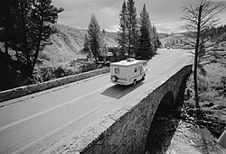
The Grand Loop Road is a historic district which encompasses the primary road system in Yellowstone National Park. Much of the 140-mile (230 km) system was originally planned by Captain Hiram M. Chittenden of the US Army Corps of Engineers in the early days of the park, when it was under military administration. The Grand Loop Road provides access to the major features of the park, including the Upper, Midway and Lower geyser basins, Mammoth Hot Springs, Tower Fall, the Grand Canyon of the Yellowstone and Yellowstone Lake.[2]
A number of other historic districts adjoin the Grand Loop in Yellowstone, including Mammoth Hot Springs, North Entrance Road, Roosevelt Lodge, Lake Fish Hatchery and Old Faithful historic districts.
Grand Loop Rd. includes unsigned portions of US 20, US 89, US 191 and US 287, all of which traverse the park. The road was named by Harry W. Frantz in 1923, who served as the park's publicist before beginning a long career as a journalist.[3]
Route
Beginning at the junction of the North Entrance Road and Grand Loop Rd. at Yellowstone National Park headquarters at Fort Yellowstone near Mammoth Hot Springs 44°58′34″N 110°42′2″W / 44.97611°N 110.70056°W / 44.97611; -110.70056 (Grand Loop Road-Mammoth Hot Springs), the road travels south, passing through Golden Gate Canyon on a viaduct and ascending the Gallatin Range, crossing Kingman Pass near Bunsen Peak. From the pass, the road descends into the Gardner River valley. At the south end of the valley, the road passes Sheepeater Cliff, a prominent columnar basalt cliff. After crossing the Gardner River, the road follows Obsidian Creek into Obsidian Canyon, passing Obsidian Cliff about halfway through the canyon. From Obsidian Canyon, the road continues south into the Norris Valley and the Norris Geyser Basin (44°43′38″N 110°41′47″W / 44.72722°N 110.69639°W / 44.72722; -110.69639 (Grand Loop Road-Norris Junction)). Here, the road meets the Gibbon River and follows it into the Gibbon Geyser Basin and Gibbon Canyon. Emerging from the canyon the Gibbon River merges with the Firehole River to form the Madison River. At this point—Madison Junction (44°38′43″N 110°51′29″W / 44.64528°N 110.85806°W / 44.64528; -110.85806 (Grand Loop Road-Madison Junction)), the road junctions with West Entrance Road which follows the Madison River west out of the park and to West Yellowstone, Montana.
Grand Loop Rd. continues to follow the Firehole River south and east. In a relatively short distance, the road travels through the three most notable geyser basins in the park: Lower Geyser Basin, Midway Geyser Basin and Upper Geyser Basin. The Old Faithful Historic District is located on Grand Loop Rd. adjacent to the Upper Geyser Basin. Turning east from Old Faithful the road crosses the Continental Divide over Craig Pass, and descends to the West Thumb Geyser Basin on the shore of Yellowstone Lake. West Thumb (44°24′49″N 110°34′42″W / 44.41361°N 110.57833°W / 44.41361; -110.57833 (Grand Loop Road-West Thumb)) is the southernmost point on Great Loop Rd. Here the road junctions with South Entrance Road which continues south to Grand Teton National Park.
Grand Loop Rd. continues north along the shore of Yellowstone Lake. Near the northern end of the lake it passes the Lake Hotel and the Lake Fish Hatchery Historic District. Just past the Lake Hotel area (44°34′1″N 110°23′11″W / 44.56694°N 110.38639°W / 44.56694; -110.38639 (Grand Loop Road-Lake)), the East Entrance Road turns right and crosses the Yellowstone River over Fishing Bridge and continues east to Cody, Wyoming. Grand Loop Rd. follows the western side of the Yellowstone River north into the Hayden Valley and past upper Yellowstone Falls near the mouth of the Grand Canyon of the Yellowstone (44°44′9″N 110°29′35″W / 44.73583°N 110.49306°W / 44.73583; -110.49306 (Grand Loop Road-Canyon)). The road then crosses Dunraven Pass near Mount Washburn and descends to Tower Fall and Tower Junction (44°54′57″N 110°24′56″W / 44.91583°N 110.41556°W / 44.91583; -110.41556 (Grand Loop Road-Tower Junction)) where it intersects with the Northeast Entrance Road to Cooke City, Montana.
From Tower Junction, the road travels north and then west through the Gallatin Range to complete the loop at Mammoth Hot Springs.
Major junctions
Counterclockwise (CCW) reads down; clockwise (CW) reads up.
| County | Location | mi[4] | km | Destinations | Notes | ||
|---|---|---|---|---|---|---|---|
| Park | Mammoth Hot Springs | 0.0 | 0.0 |   US 89 north (North Entrance Road) – Visitor Center, Campground, Gardiner US 89 north (North Entrance Road) – Visitor Center, Campground, Gardiner | CW end of US 89 overlap | ||
| Stretch of road closed December–April | |||||||
| Madison Junction | 34.3 | 55.2 |     US 20 west / US 191 / US 287 north (West Entrance Road) – Campground, West Yellowstone US 20 west / US 191 / US 287 north (West Entrance Road) – Campground, West Yellowstone | CW end of US 20/US 191/US 287 overlap; West Entrance Rd. closed December–April | |||
| Teton | | 50.2 | 80.8 | Old Faithful | Interchange | ||
| West Thumb Geyser Basin | 67.8 | 109.1 |  US 89 / US 191 / US 287 south (South Entrance Road) – Grant Village, Lewis Lake, Grand Teton, Jackson US 89 / US 191 / US 287 south (South Entrance Road) – Grant Village, Lewis Lake, Grand Teton, Jackson | CCW end of US 89/US 191/US 287 overlap; South Entrance Rd. closed winters | |||
| Stretch of road closed winters | |||||||
| Fishing Bridge | 88.4 | 142.3 |    US 14 / US 16 / US 20 east (East Entrance Road) – Sylvan Pass, Cody US 14 / US 16 / US 20 east (East Entrance Road) – Sylvan Pass, Cody | CCW end of US 20 overlap; western terminus of US 14/US 16; East Entrance Rd. closed winters | |||
| Stretch of road closed winters | |||||||
| Park | Tower Junction | 122.0 | 196.3 |  US 212 east (Northeast Entrance Road) – Northeast Entrance, Silver Gate, Cooke City US 212 east (Northeast Entrance Road) – Northeast Entrance, Silver Gate, Cooke City | Western terminus of US 212 | ||
| Mammoth Hot Springs | 140.1 | 225.5 | US 89 north (North Entrance Road) – Visitor Center, Campground, Gardiner | See above | |||
| |||||||
See also
- Fort Yellowstone
- Lake Fish Hatchery Historic District
- Mammoth Hot Springs Historic District
- North Entrance Road Historic District
- Roosevelt Lodge Historic District
- Old Faithful Historic District
References
- ^ "National Register Information System". National Register of Historic Places. National Park Service. April 15, 2008.
- ^ "Grand Loop Road Historic District". National Register of Historic Places. Wyoming State Preservation Office. October 24, 2008. Archived from the original on June 15, 2011. Retrieved August 17, 2010.
- ^ "Yellowstone Net". Archived from the original on May 13, 2008.
- ^ "Overview of Grand Loop Rd". Google Maps. Google, Inc. Retrieved September 11, 2016.
External links
Wikimedia Commons has media related to Grand Loop Road Historic District.
- "The History of the Construction of the Road System in Yellowstone National Park". National Park Service.
- Grand Loop Road Historic District Archived 2011-06-15 at the Wayback Machine at the Wyoming State Historic Preservation Office
- Historic American Engineering Record (HAER) documentation filed under Lake, Teton County, WY, except as noted below:
- HAER No. WY-24, "Yellowstone Roads & Bridges", 86 photos, 12 measured drawings, 255 data pages, 7 photo caption pages
- HAER No. WY-28, "Seven Mile Bridge, Spanning Gardner River at Grand Loop Road", 3 photos, 1 color transparency, 6 measured drawings, 23 data pages, 1 photo caption page
- HAER No. WY-29, "Gibbon River Bridge No. 1, Spanning Gibbon River at Grand Loop Road", 6 photos, 3 measured drawings, 4 data pages, 1 photo caption page
- HAER No. WY-30, "Gibbon River Bridge No. 2, Spanning Gibbon River at Grand Loop Road", 1 photo, 4 data pages, 1 photo caption page
- HAER No. WY-31, "Isa Lake Bridge, Spanning Isa Lake at Grand Loop Road", 3 photos, 14 data pages, 1 photo caption page
- HAER No. WY-32, "Otter Creek Bridge No. 1, Spanning Otter Creek at Grand Loop Road", 3 photos, 3 data pages, 1 photo caption page
- HAER No. WY-33, "Tower Creek Bridge, Spanning Tower Creek at Grand Loop Road", 2 photos, 17 data pages, 1 photo caption page
- HAER No. WY-34, "Lava Creek Bridge, Spanning Lava Creek at Grand Loop Road", 2 photos, 10 data pages, 1 photo caption page
- HAER No. WY-47, "Otter Creek Bridge No. 2, Spanning Otter Creek at spur of Grand Loop Road", 1 photo, 3 data pages, 1 photo caption page
- HAER No. WY-48, "Nez Perce Bridge, Spanning Nez Perce Creek at Grand Loop Road", 4 photos, 11 data pages, 1 photo caption page
- HAER No. WY-55, "Grand Loop Road, Forming circuit between Mammoth Hot Springs, Norris Junction, Madison Junction, Old Faithful, Mammoth, Park County, WY", 6 color transparencies, 65 data pages, 1 photo caption page
| ||
|---|---|---|
| National Historic Landmarks |  | |
| Historic districts | ||
| Other properties |
| |

Yellowstone National Park - Tower-Roosevelt and Lamar Valley | ||
|---|---|---|
Geography, historic structures and other attractions in the Tower Roosevelt and Lamar Valley areas | ||
| Structures and history |  | |
| Geography and geology |
| |
| ||
Yellowstone National Park – lake and environs | ||
|---|---|---|
Historic structures and other attractions in the Yellowstone Lake, West Thumb, South and East Entrance areas | ||
| Structures and history |  | |
| West Thumb Geyser Basin | ||
| Geography and geology |
| |


