Gorayk
Place in Syunik, Armenia
Gorayk Գորայք | |
|---|---|
 | |
39°40′58″N 45°45′41″E / 39.68278°N 45.76139°E / 39.68278; 45.76139 | |
| Country |  Armenia Armenia |
| Province | Syunik |
| Municipality | Gorayk |
| Area | |
| • Total | 67.57 km2 (26.09 sq mi) |
| Population (2011)[2] | |
| • Total | 435 |
| • Density | 6.4/km2 (17/sq mi) |
| Time zone | UTC+4 (AMT) |
Gorayk (Armenian: Գորայք) is a village and the center of the Gorayk Municipality of the Syunik Province in Armenia. A large reservoir called the Spandaryan Reservoir lies to the southeast of the village.
Toponymy
The village was previously known as Bazarchay.
Demographics
The National Statistical Service of the Republic of Armenia (ARMSTAT) reported the village population as 580 in 2010,[3] down from 632 at the 2001 census.[4]
Gallery
-
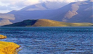 Spandarian Reservoir
 -
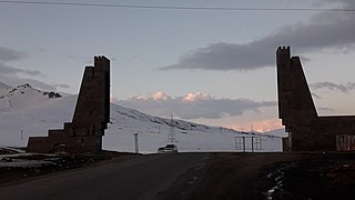 "Zangezur Gates"
 -
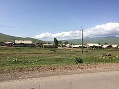 A view of the village
 -
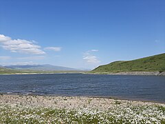 Spandarian Reservoir
 -
 A view of the village


References
Wikimedia Commons has media related to Gorayk.
- ^ "Syunik regional e-Governance System" (in Armenian). Syunik Province provincial government. Click on link entitled "Համայնքներ" (community) and search for the place by Armenian name.
- ^ Statistical Committee of Armenia. "The results of the 2011 Population Census of the Republic of Armenia" (PDF).
- ^ "Marzes of Armenia and Yerevan City in Figures, 2010" (PDF). Statistical Committee of Armenia.
- ^ Report of the results of the 2001 Armenian Census, Statistical Committee of Armenia
- v
- t
- e
Capital: Kapan

- Gorayk
- Tsghuk
- Sarnakunk
- Spandaryan
- Achanan
- Agarak
- Aghvani
- Antarashat
- Arajadzor
- Artsvanik
- Bargushat
- Chakaten
- Chapni
- Davit Bek
- Ditsmayri
- Dzorastan
- Geghanush
- Gomaran
- Kaghnut
- Khdrants
- Khordzor
- Nerkin Hand
- Nerkin Khotanan
- Norashenik
- Okhtar
- Sevakar
- Shikahogh
- Shishkert
- Shrvenants
- Srashen
- Syunik
- Sznak
- Tandzaver
- Tavrus
- Tsav
- Uzhanis
- Vanek
- Vardavank
- Verin Khotanan
- Yegheg
- Yeghvard
- Erkenants [hy]
Portal:
 Geography

 | This article about a location in Syunik Province, Armenia is a stub. You can help Wikipedia by expanding it. |
- v
- t
- e


