Chakradharpur railway station

Rail station in Jharkhand, India

22°40′34″N 85°37′26″E / 22.676°N 85.624°E / 22.676; 85.624Elevation227 metres (745 ft)Owned byIndian RailwaysLine(s)Tatanagar–Bilaspur section of Howrah–Nagpur–Mumbai linePlatforms3ConstructionStructure typeAt groundParkingAvailableOther informationStation codeCKP Zone(s) South Eastern Railway Division(s) Chakradharpur railway divisionHistoryOpened1890Electrified1961–62Previous namesBengal Nagpur RailwayServices
Preceding station Indian Railways Following station
Barabambo
towards ?
South Eastern Railway zone Lotapahar
towards ?
Location
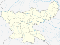
Chadrakharpur is located in Jharkhand
Chadrakharpur
Chadrakharpur
Location of in Jharkhand
Show map of Jharkhand
Chadrakharpur is located in India
Chadrakharpur
Chadrakharpur
Location in India
Show map of India

Chakraharpur Railway Station serves Chakradharpur in West Singhbhum district in the Indian state of Jharkhand.

History

The Bengal Nagpur Railway was formed in 1887 for the purpose of upgrading the Nagpur Chhattisgarh Railway and then extending it via Bilaspur to Asansol, in order to develop a shorter Howrah–Mumbai route than the one via Allahabad.[1] The Bengal Nagpur Railway main line from Nagpur to Asansol, on the Howrah–Delhi main line, was opened for goods traffic on 1 February 1891.[2]

Electrification

The Purulia–Chakradharpur, Kandra–Gomharria, Sini–Adityapur, Adityapur–Tatanagar, Chakradharpur–Manoharpur and Manoharpur–Rourkela sections were electrified in 1961–62.[3]

References

  1. ^ "Number 1 Down Mail". Railways of the Raj. Retrieved 10 November 2012.
  2. ^ "Major Events in the Formation of S.E. Railway". South Eastern Railway. Archived from the original on 1 April 2013. Retrieved 2012-11-10.
  3. ^ "History of Electrification". IRFCA. Retrieved 10 November 2012.

External links

  • Trains at Chakradharpur
  • v
  • t
  • e
ERTooltip Eastern Railway zone
Asansol
Howrah
Malda
ECRTooltip East Central Railway zone
Dhanbad
SERTooltip South Eastern Railway zone
Adra
Chakradharpur
Ranchi
  • v
  • t
  • e
General
Districts
Subdivisions
Community development blocks
Seraikela Kharsawan
East Singhbhum
Rivers, waterfalls, dams
Languages, people
Railway stations
Transport
Industries
Institutes of higher learning
Lok Sabha constituencies
  • Jamshedpur
  • Singhbhum
  • Ranchi
  • Khunti (ST)
Vidhan Sabha
constituencies
Jamshedpur
  • Baharagora
  • Ghatsila
  • Potka
  • Jugsalai
  • Jamshedpur East
  • Jamshedpur West
Singhbhum
  • Seraikella (ST)
  • Chaibasa
  • Majhgaon
  • Jaganathpur
  • Manoharpur
  • Chakradharpur
Ranchi
  • Ichagarh
Khunti (ST)
  • Kharsawan (ST)
See also
  • Cities and towns in Kolhan Division
  • Villages in Seraikela Kharswan district
  • Villages in East Singhbhum district
  • Mahanadi-Brahmani-Bitarani Basin
Other Divisions
  • North Chotanagpur
  • South Chotanagpur
  • Palamu
  • Santhal Pargana