Brockway, Montana
Census-designated place in Montana, United States
47°17′59″N 105°45′47″W / 47.29972°N 105.76306°W / 47.29972; -105.76306 (2020)[2]
59214
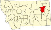
Brockway is an unincorporated community and census-designated place (CDP) in southern McCone County, Montana, United States, located near the Redwater River. As of the 2020 census, the first year it was listed as a CDP, the population was 14.[2]
Brockway is home to the annual Brockway Dairy Day Rodeo.
History
Brockway is named for three homesteader brothers.[3] The post office was opened in 1913.[4] The Northern Pacific Railway's Redwater branch line reached the town in 1928.
The town "became a major livestock shipping point reaching number one in the U.S. in 1934," according to historical marker author Bob Fletcher.[5]
Geography
Brockway is located along Montana Secondary Highway 253, 1 mile (1.6 km) south of Montana Highway 200, along the Big Sky Back Country Byway.[6][7] It is 12 miles (19 km) southwest of Circle, the McCone county seat.
According to the U.S. Census Bureau, the Brockway CDP has an area of 0.35 square miles (0.91 km2), all land.[1] The Redwater River, a northeast-flowing tributary of the Missouri, passes just west and north of the community.
Demographics
| Census | Pop. | Note | %± |
|---|---|---|---|
| 2020 | 14 | — | |
| U.S. Decennial Census[8] | |||
Climate
According to the Köppen Climate Classification system, Brockway has a semi-arid climate, abbreviated "BSk" on climate maps.
| Climate data for Brockway, Montana (1991–2020 normals, extremes 1959–present) | |||||||||||||
|---|---|---|---|---|---|---|---|---|---|---|---|---|---|
| Month | Jan | Feb | Mar | Apr | May | Jun | Jul | Aug | Sep | Oct | Nov | Dec | Year |
| Record high °F (°C) | 68 (20) | 71 (22) | 84 (29) | 91 (33) | 101 (38) | 110 (43) | 108 (42) | 108 (42) | 104 (40) | 94 (34) | 78 (26) | 68 (20) | 110 (43) |
| Mean daily maximum °F (°C) | 28.8 (−1.8) | 32.5 (0.3) | 44.5 (6.9) | 56.6 (13.7) | 66.7 (19.3) | 76.2 (24.6) | 85.2 (29.6) | 84.8 (29.3) | 73.3 (22.9) | 57.4 (14.1) | 42.6 (5.9) | 31.4 (−0.3) | 56.7 (13.7) |
| Daily mean °F (°C) | 18.0 (−7.8) | 21.5 (−5.8) | 32.6 (0.3) | 43.6 (6.4) | 53.5 (11.9) | 63.2 (17.3) | 70.5 (21.4) | 69.5 (20.8) | 58.7 (14.8) | 44.7 (7.1) | 31.1 (−0.5) | 20.8 (−6.2) | 44.0 (6.7) |
| Mean daily minimum °F (°C) | 7.2 (−13.8) | 10.5 (−11.9) | 20.7 (−6.3) | 30.7 (−0.7) | 40.4 (4.7) | 50.1 (10.1) | 55.8 (13.2) | 54.3 (12.4) | 44.0 (6.7) | 31.9 (−0.1) | 19.5 (−6.9) | 10.2 (−12.1) | 31.3 (−0.4) |
| Record low °F (°C) | −44 (−42) | −47 (−44) | −36 (−38) | −9 (−23) | 12 (−11) | 24 (−4) | 33 (1) | 25 (−4) | 14 (−10) | −10 (−23) | −35 (−37) | −43 (−42) | −47 (−44) |
| Average precipitation inches (mm) | 0.24 (6.1) | 0.18 (4.6) | 0.29 (7.4) | 1.16 (29) | 2.48 (63) | 2.54 (65) | 2.07 (53) | 1.14 (29) | 1.08 (27) | 0.86 (22) | 0.21 (5.3) | 0.20 (5.1) | 12.45 (316) |
| Average precipitation days (≥ 0.01 in) | 2.4 | 2.2 | 2.6 | 4.7 | 7.2 | 7.8 | 5.7 | 3.6 | 3.6 | 3.0 | 1.7 | 1.5 | 46.0 |
| Source: NOAA[9][10] | |||||||||||||
References
- ^ a b "2023 U.S. Gazetteer Files: Montana". United States Census Bureau. Retrieved May 17, 2024.
- ^ a b "P1. Race – Brockway CDP, Montana: 2020 DEC Redistricting Data (PL 94-171)". U.S. Census Bureau. Retrieved May 17, 2024.
- ^ "Montana Place Names Companion". Montana Historical Society. Retrieved July 29, 2017.
- ^ Carkeek Cheney, Roberta (1983). Names on the Face of Montana. Missoula, Montana: Mountain Press Publishing Company. ISBN 0-87842-150-5.
- ^ Wilson, Kurt (November 2, 2014). "Roadside Wanderings: Resilient northeastern Montana". Missoulian. Retrieved November 2, 2014.
- ^ "Big Sky Back Country Byway". Federal Highway Administration, United States Department of Transportation. Archived from the original on July 31, 2012. Retrieved January 30, 2007.
- ^ "Big Sky Back Country Byway". Travel Montana, State of Montana. Retrieved January 30, 2007.[permanent dead link]
- ^ "Census of Population and Housing". Census.gov. Retrieved June 4, 2016.
- ^ "NOWData - NOAA Online Weather Data". National Oceanic and Atmospheric Administration. Retrieved December 15, 2023.
- ^ "Summary of Monthly Normals 1991-2020". National Oceanic and Atmospheric Administration. Retrieved December 15, 2023.
External links
- Brockway community website
- v
- t
- e
Municipalities and communities of McCone County, Montana, United States
County seat: Circle
- Brockway
- Prairie Elk Colony
- Vida
‡This populated place also has portions in an adjacent county or counties
- Montana portal
- United States portal
Authority control databases | |
|---|---|
| International |
|
| National |
|
 | This McCone County, Montana state location article is a stub. You can help Wikipedia by expanding it. |
- v
- t
- e


