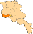
Alashkert, Armenia
40°06′48″N 44°03′19″E / 40.11333°N 44.05528°E / 40.11333; 44.05528
Alashkert Ալաշկերտ | |
|---|---|
  Alashkert | |
| Coordinates: 40°06′48″N 44°03′19″E / 40.11333°N 44.05528°E / 40.11333; 44.05528 | |
| Country |  Armenia Armenia |
| Province | Armavir |
| Population (2011)[1] | |
| • Total | 1,569 |
| Time zone | UTC+4 (AMT) |
Alashkert (Armenian: Ալաշկերտ) is a village in the Armavir Province of Armenia.
Toponymy
Prior to 1935 the village was known as Kyarimarkh. The village was then known as Sovetakan between 1935 and 2008. In 2008, the village was renamed Alashkert, after the historic Western Armenian town of Alashkert, from which many of its inhabitants had escaped in 1918.
History
The village was populated by Iranian Azerbaijanis who were forcibly settled in Alashkert as part of raising Muslim dominance in the region. Armenian migrants settled in the region in 1918 after having escaped from Western Armenia. [2]
References
- ^ Statistical Committee of Armenia. "The results of the 2011 Population Census of Armenia" (PDF).
- ^ "Ալաշկերտ". caa.am. Retrieved 15 February 2021.
External links
- Report of the results of the 2001 Armenian Census, Statistical Committee of Armenia
- Kiesling, Brady (June 2000). Rediscovering Armenia: An Archaeological/Touristic Gazetteer and Map Set for the Historical Monuments of Armenia (PDF). Archived (PDF) from the original on 6 November 2021.
- v
- t
- e
 Armavir Province
 | This article about a location in Armavir Province, Armenia is a stub. You can help Wikipedia by expanding it. |
- v
- t
- e


