Aguilares, El Salvador
Salvadoran City
You can help expand this article with text translated from the corresponding article in Spanish. (June 2023) Click [show] for important translation instructions.
- Machine translation, like DeepL or Google Translate, is a useful starting point for translations, but translators must revise errors as necessary and confirm that the translation is accurate, rather than simply copy-pasting machine-translated text into the English Wikipedia.
- Do not translate text that appears unreliable or low-quality. If possible, verify the text with references provided in the foreign-language article.
- You must provide copyright attribution in the edit summary accompanying your translation by providing an interlanguage link to the source of your translation. A model attribution edit summary is
Content in this edit is translated from the existing Spanish Wikipedia article at [[:es:Aguilares (El Salvador)]]; see its history for attribution. - You may also add the template
{{Translated|es|Aguilares (El Salvador)}}to the talk page. - For more guidance, see Wikipedia:Translation.
Municipality in San Salvador Department, El Salvador

Flag

Seal
 El Salvador
 (2006)
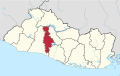
Aguilares is a municipality in the San Salvador department of El Salvador, located 33 km away from the city of San Salvador. The municipality measures 33.72 km² and as of 2006, had an estimated population of 73,300. Sugar cane cultivation is the major economic activity for the area.[citation needed]
The municipality is divided into five administrative divisions, called cantones: Florida, Las Tunas, Pinalitos, Pishishapa, and Los Mangos.[citation needed] It is bounded on the north by El Paisnal, on the east by Suchitoto (Cuscatlán Department) and Guazapa, to the south by Nejapa and Guazapa, and to the west by Quezaltepeque (La Libertad Department) and El Paisnal.
Toponymy
The municipality was named in honor of Nicolás [es], Vicente [es], and Manuel Aguilar, leaders in the Salvadoran independence movement.[citation needed]
History
In the 1970s, the associated Catholic parish of Aguilares was served by Rutilio Grande, a Jesuit priest and activist who was assassinated on the outskirts of town.[1] In 1979 or 1980, during the Salvadoran Civil War, the Salvadoran Army pillaged the town until its people retook it, depicted in Archbishop of San Salvador Óscar Romero's homily as images of the crucified Christ.[2]
References
- ^ "The Catholic Transcript, Volume LXX, Number 13, 5 August 1977: The Catholic Transcript". The Catholic Transcript. 5 August 1977. p. 11.
- ^ Tomb, David (1 September 2021). "Chapter Ten Deepening the Commitment and Expanding the View". Latin American Liberation Theology (eBook ed.). Leiden: Brill Publishers. p. 277. ISBN 9789004496460.
- v
- t
- e

Capital: San Salvador
- Cerro Cinotepeque
- Cerrón Grande Reservoir
- Guazapa Volcano
- Lake Ilopango
- Casa Presidencial
- Cemetery of Distinguished Citizens
- Estadio Cuscatlán
- Estadio Jorge "Mágico" González
- Estadio Las Delicias
- Estadio Nacional de El Salvador
- Estadio Universitario UES
- Gimnasio Nacional José Adolfo Pineda
- Government Center Tower
- Iglesia El Carmen
- Ilopango International Airport
- Lifestyle Center La Gran Via
- Monumento al Divino Salvador del Mundo
- Museo de la Palabra y la Imagen
- National Palace
- Plaza Gerardo Barrios
- San Salvador Cathedral
- San Salvador Historic Downtown
- Teatro Nacional de El Salvador
- World Trade Center San Salvador
13°57′N 89°11′W / 13.950°N 89.183°W / 13.950; -89.183
 | This El Salvador location article is a stub. You can help Wikipedia by expanding it. |
- v
- t
- e


